Fushun geodata
Fushun (Liaoning) is a seat of a second-order administrative division; located in China in Asia/Shanghai (GMT+8) time zone. With population of 1,400,646 people, there are 48 cities with bigger population in this country. Compared to other cities in China, 90.8% of cities are located further ↓South; 93.7% of cities are located further ←West and 62.9% of cities have higher elevation than Fushun. Note1


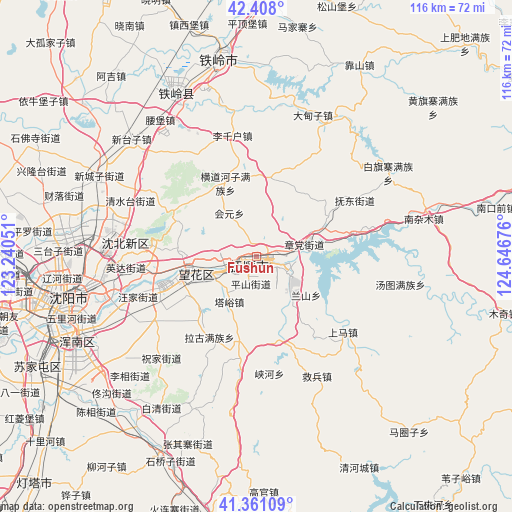
Fushun GPS coordinates[2]
41° 53' 12.084" North, 123° 56' 37.068" East
| Map corner | latitude | longitude |
|---|---|---|
| Upper-left | 42.408°, | 123.24051° |
| Center: | 41.88669°, | 123.94363° |
| Lower-right: | 41.36109°, | 124.64676° |
| Map W x H: | 116.4×116.4 km | = 72.3×72.3mi |
| max Lat: | 53.31946° ⇑9.2% North |
| Fushun: | 41.88669° |
| min Lat: | ⇓90.8% South 18.22056° |
| min Long | Fushun | max Long |
| 75.07348° | 123.94363° | 134.28917° |
| W 93.7%⇐ | ⇒6.3% E |
Elevation
Elevation of Fushun is 83 m = 272 ft, and this is 401.8 m = 1318 ft below average elevation for this country.
| Max E: |
5622 m = 18445 ft | 62.9% |
| Avg. | 484.8 m = 1591 ft | |
| Fushun | 83 m = 272 ft | |
Min E: |
-3 m = -10 ft | 37.1% |
See also: Fushun elevation on elevation.city.
Geographical zone
Fushun is located in North temperate zone (between Tropic of Cancer and the Arctic Circle). Distance of this Northern Tropic circle is 2051.4 km =1274.7 mi to South.| Distance of | km | miles | from Fushun |
|---|---|---|---|
| North Pole | 5349.7 | 3324.1 | to North |
| Arctic Circle | 2743.8 | 1704.9 | to North |
| Tropic Cancer | 2051.4 | 1274.7 | to South |
| Equator | 4657.4 | 2894 | to South |


Nearby cities:
15 places around Fushun: (largest is in red/bold)
• Dongling
31.5 km =19.6 mi,  255°
255°
• Dongzhou
8.2 km =5.1 mi,  107°
107°
• Hada
18.9 km =11.7 mi,  59°
59°
• Hou’an
30.2 km =18.8 mi,  132°
132°
• Hushitai
37 km =23 mi,  279°
279°
• Jiubing
30.5 km =19 mi,  153°
153°
• Lanshan
15.9 km =9.9 mi, 127°
• Nanzamu
39.7 km =24.7 mi,  76°
76°
• Nianpan
10.6 km =6.6 mi, 133°
• Qiandian
4.9 km =3 mi, 79°
• Shangma
20.7 km =12.9 mi,  124°
124°
• Shenyang
43.6 km =27.1 mi, 256°
• Tangtu
33.2 km =20.6 mi,  101°
101°
• Zhangdang
11.1 km =6.9 mi, 77°
• Zhangdian
11.2 km =7 mi, 133°
Sources, notices
• [Note1] Compared only with cities in China existing in our database
• [Src1] Map data: © OpenStreetMap contributors (CC-BY-SA)
• [Src2] Other city data from geonames.org with taken over terms of usage.
• [Src3] Geographical zone / Annual Mean Temperature by Robert A. Rohde @ Wikipedia
