Shangma geodata
Shangma (Liaoning) is a seat of a fourth-order administrative division; located in China in Asia/Shanghai (GMT+8) time zone. In our database, there are 1268 cities with bigger population. Compared to other cities in China, 90.6% of cities are located further ↓South; 94% of cities are located further ←West and 54.2% of cities have lower elevation than Shangma. Note1


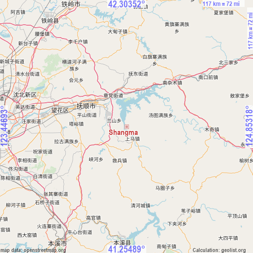
Shangma GPS coordinates[2]
41° 46' 52.86" North, 124° 9' 0.18" East
| Map corner | latitude | longitude |
|---|---|---|
| Upper-left | 42.30352°, | 123.44693° |
| Center: | 41.78135°, | 124.15005° |
| Lower-right: | 41.25489°, | 124.85318° |
| Map W x H: | 116.6×116.6 km | = 72.5×72.5mi |
| max Lat: | 53.31946° ⇑9.4% North |
| Shangma: | 41.78135° |
| min Lat: | ⇓90.6% South 18.22056° |
| min Long | Shangma | max Long |
| 75.07348° | 124.15005° | 134.28917° |
| W 94%⇐ | ⇒6% E |
Elevation
Elevation of Shangma is 199 m = 653 ft, and this is 285.8 m = 938 ft below average elevation for this country.
| Max E: |
5622 m = 18445 ft | 45.8% |
| Avg. | 484.8 m = 1591 ft | |
| Shangma | 199 m = 653 ft | |
Min E: |
-3 m = -10 ft | 54.2% |
See also: China elevation on elevation.city.
Geographical zone
Shangma is located in North temperate zone (between Tropic of Cancer and the Arctic Circle). Distance of this Northern Tropic circle is 2039.7 km =1267.4 mi to South.| Distance of | km | miles | from Shangma |
|---|---|---|---|
| North Pole | 5361.4 | 3331.4 | to North |
| Arctic Circle | 2755.5 | 1712.2 | to North |
| Tropic Cancer | 2039.7 | 1267.4 | to South |
| Equator | 4645.7 | 2886.7 | to South |


Nearby cities:
15 places around Shangma: (largest is in red/bold)
• Dongzhou
13.1 km =8.1 mi,  314°
314°
• Fushun
20.7 km =12.9 mi,  304°
304°
• Hada
21.2 km =13.2 mi,  358°
358°
• Hou’an
10.1 km =6.3 mi,  148°
148°
• Jiubing
15.8 km =9.8 mi,  192°
192°
• Lanshan
5 km =3.1 mi,  293°
293°
• Majuanzi
33.8 km =21 mi, 147°
• Nanzamu
30.1 km =18.7 mi,  45°
45°
• Nianpan
10.3 km =6.4 mi, 295°
• Qiandian
17.6 km =10.9 mi,  315°
315°
• Shangjiahe
28.7 km =17.8 mi,  74°
74°
• Tangtu
16.3 km =10.1 mi, 71°
• Xiayingzi
34 km =21.1 mi,  100°
100°
• Zhangdang
15.4 km =9.6 mi,  335°
335°
• Zhangdian
9.9 km =6.2 mi, 293°
Sources, notices
• [Note1] Compared only with cities in China existing in our database
• [Src1] Map data: © OpenStreetMap contributors (CC-BY-SA)
• [Src2] Other city data from geonames.org with taken over terms of usage.
• [Src3] Geographical zone / Annual Mean Temperature by Robert A. Rohde @ Wikipedia
