Longtou geodata
Longtou (Guangdong) is a seat of a fourth-order administrative division; located in China in Asia/Urumqi (GMT+6) time zone. In our database, there are 1268 cities with bigger population. Compared to other cities in China, 98.3% of cities are located further ↑North; 69% of cities are located further →East and 76.7% of cities have higher elevation than Longtou. Note1


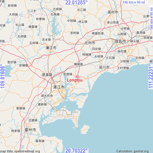
Longtou GPS coordinates[2]
21° 21' 34.2" North, 110° 31' 9.048" East
| Map corner | latitude | longitude |
|---|---|---|
| Upper-left | 22.01285°, | 109.81606° |
| Center: | 21.3595°, | 110.51918° |
| Lower-right: | 20.70322°, | 111.22231° |
| Map W x H: | 145.6×145.6 km | = 90.5×90.5mi |
| max Lat: | 53.31946° ⇑98.3% North |
| Longtou: | 21.3595° |
| min Lat: | ⇓1.7% South 18.22056° |
| min Long | Longtou | max Long |
| 75.07348° | 110.51918° | 134.28917° |
| W 31%⇐ | ⇒69% E |
Elevation
Elevation of Longtou is 33 m = 108 ft, and this is 451.8 m = 1482 ft below average elevation for this country.
| Max E: |
5622 m = 18445 ft | 76.7% |
| Avg. | 484.8 m = 1591 ft | |
| Longtou | 33 m = 108 ft | |
Min E: |
-3 m = -10 ft | 23.3% |
See also: China elevation on elevation.city.
Geographical zone
Longtou is located in North Torrid zone (between Equator and Tropic of Cancer). Distance of this Northern Tropic circle is 231 km =143.5 mi to North.| Distance of | km | miles | from Longtou |
|---|---|---|---|
| North Pole | 7632.1 | 4742.4 | to North |
| Arctic Circle | 5026.2 | 3123.1 | to North |
| Tropic Cancer | 231 | 143.5 | to North |
| Equator | 2375 | 1475.8 | to South |


Nearby cities:
15 places around Longtou: (largest is in red/bold)
• Chikan
19.3 km =12 mi,  239°
239°
• Guandu
8.9 km =5.5 mi,  288°
288°
• Huangpo
8.6 km =5.3 mi,  123°
123°
• Liangdong
20.1 km =12.5 mi,  320°
320°
• Nandiao
14.2 km =8.8 mi,  212°
212°
• Nanqiao
19.5 km =12.1 mi, 238°
• Potou
13.3 km =8.3 mi,  220°
220°
• Qiantang
17.2 km =10.7 mi,  145°
145°
• Tangtuzhui
12.9 km =8 mi,  8°
8°
• Tangwei
22 km =13.7 mi,  79°
79°
• Wuyang
17.6 km =10.9 mi,  94°
94°
• Zhangpu
20.9 km =13 mi,  60°
60°
• Zhanjiang
20.2 km =12.6 mi, 244°
• Zhenwen
17.9 km =11.1 mi,  72°
72°
• Zhongshan
7 km =4.3 mi,  128°
128°
Sources, notices
• [Note1] Compared only with cities in China existing in our database
• [Src1] Map data: © OpenStreetMap contributors (CC-BY-SA)
• [Src2] Other city data from geonames.org with taken over terms of usage.
• [Src3] Geographical zone / Annual Mean Temperature by Robert A. Rohde @ Wikipedia
