Ganglie geodata
Ganglie (Guangdong) is a seat of a fourth-order administrative division; located in China in Asia/Shanghai (GMT+8) time zone. In our database, there are 1268 cities with bigger population. Compared to other cities in China, 97.5% of cities are located further ↑North; 62.9% of cities are located further →East and 86.9% of cities have higher elevation than Ganglie. Note1


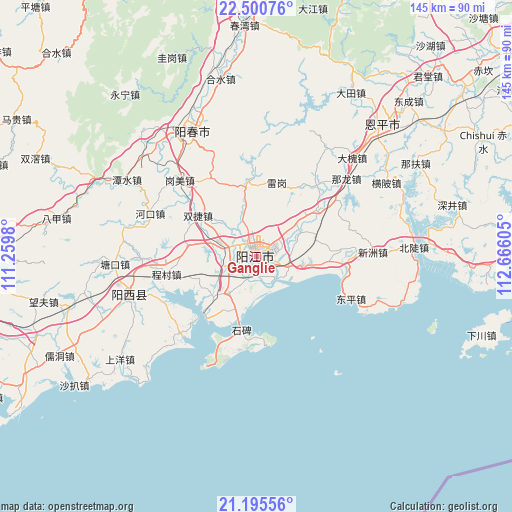
Ganglie GPS coordinates[2]
21° 50' 58.74" North, 111° 57' 46.512" East
| Map corner | latitude | longitude |
|---|---|---|
| Upper-left | 22.50076°, | 111.2598° |
| Center: | 21.84965°, | 111.96292° |
| Lower-right: | 21.19556°, | 112.66605° |
| Map W x H: | 145.1×145.1 km | = 90.2×90.2mi |
| max Lat: | 53.31946° ⇑97.5% North |
| Ganglie: | 21.84965° |
| min Lat: | ⇓2.5% South 18.22056° |
| min Long | Ganglie | max Long |
| 75.07348° | 111.96292° | 134.28917° |
| W 37.1%⇐ | ⇒62.9% E |
Elevation
Elevation of Ganglie is 13 m = 43 ft, and this is 471.8 m = 1548 ft below average elevation for this country.
| Max E: |
5622 m = 18445 ft | 86.9% |
| Avg. | 484.8 m = 1591 ft | |
| Ganglie | 13 m = 43 ft | |
Min E: |
-3 m = -10 ft | 13.1% |
See also: China elevation on elevation.city.
Geographical zone
Ganglie is located in North Torrid zone (between Equator and Tropic of Cancer). Distance of this Northern Tropic circle is 176.5 km =109.7 mi to North.| Distance of | km | miles | from Ganglie |
|---|---|---|---|
| North Pole | 7577.6 | 4708.5 | to North |
| Arctic Circle | 4971.7 | 3089.3 | to North |
| Tropic Cancer | 176.5 | 109.7 | to North |
| Equator | 2429.5 | 1509.6 | to South |


Nearby cities:
15 places around Ganglie: (largest is in red/bold)
• Baisha
9.5 km =5.9 mi,  285°
285°
• Beiguan
14.1 km =8.8 mi,  49°
49°
• Buchang
8.9 km =5.5 mi,  207°
207°
• Chengcun
27.1 km =16.8 mi,  259°
259°
• Chengxi
3.7 km =2.3 mi,  224°
224°
• Daba
24.9 km =15.5 mi,  359°
359°
• Dagou
20 km =12.4 mi,  94°
94°
• Dongcheng
6.1 km =3.8 mi, 53°
• Dongping
29 km =18 mi,  115°
115°
• Heshan
21.3 km =13.2 mi, 52°
• Pinggang
13.7 km =8.5 mi, 219°
• Shuangjie
21.4 km =13.3 mi,  299°
299°
• Tangping
20.4 km =12.7 mi,  352°
352°
• Yangjiang
0.7 km =0.4 mi, 358°
• Yashao
9.4 km =5.8 mi,  109°
109°
Sources, notices
• [Note1] Compared only with cities in China existing in our database
• [Src1] Map data: © OpenStreetMap contributors (CC-BY-SA)
• [Src2] Other city data from geonames.org with taken over terms of usage.
• [Src3] Geographical zone / Annual Mean Temperature by Robert A. Rohde @ Wikipedia
