Jiajiaba geodata
Jiajiaba (Hunan) is a seat of a fourth-order administrative division; located in China in Asia/Shanghai (GMT+8) time zone. In our database, there are 1268 cities with bigger population. Compared to other cities in China, 63.9% of cities are located further ↑North; 74.5% of cities are located further →East and 83% of cities have lower elevation than Jiajiaba. Note1


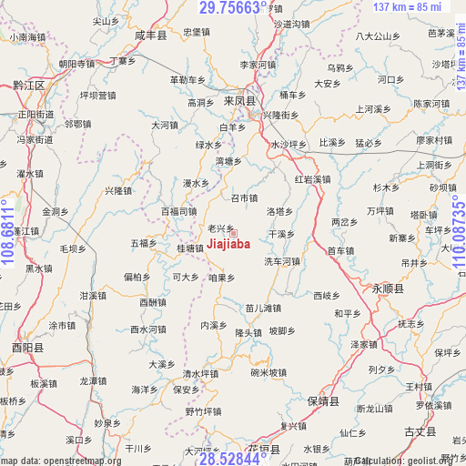
Jiajiaba GPS coordinates[2]
29° 8' 39.732" North, 109° 23' 3.192" East
| Map corner | latitude | longitude |
|---|---|---|
| Upper-left | 29.75663°, | 108.6811° |
| Center: | 29.14437°, | 109.38422° |
| Lower-right: | 28.52844°, | 110.08735° |
| Map W x H: | 136.6×136.6 km | = 84.9×84.9mi |
| max Lat: | 53.31946° ⇑63.9% North |
| Jiajiaba: | 29.14437° |
| min Lat: | ⇓36.1% South 18.22056° |
| min Long | Jiajiaba | max Long |
| 75.07348° | 109.38422° | 134.28917° |
| W 25.5%⇐ | ⇒74.5% E |
Elevation
Elevation of Jiajiaba is 847 m = 2779 ft, and this is 362.2 m = 1188 ft above average elevation for this country.
| Max E: |
5622 m = 18445 ft | 17% |
| Jiajiaba | 847 m 2779 ft | |
| Avg. | 484.8 m = 1591 ft | |
Min E: |
-3 m = -10 ft | 83% |
See also: China elevation on elevation.city.
Geographical zone
Jiajiaba is located in North temperate zone (between Tropic of Cancer and the Arctic Circle). Distance of this Northern Tropic circle is 634.6 km =394.3 mi to South.| Distance of | km | miles | from Jiajiaba |
|---|---|---|---|
| North Pole | 6766.5 | 4204.5 | to North |
| Arctic Circle | 4160.6 | 2585.3 | to North |
| Tropic Cancer | 634.6 | 394.3 | to South |
| Equator | 3240.6 | 2013.6 | to South |


Nearby cities:
15 places around Jiajiaba: (largest is in red/bold)
• Baifusi
17.3 km =10.7 mi,  292°
292°
• Chenzhouzhai
16.3 km =10.1 mi,  28°
28°
• Fengxizhai
16.4 km =10.2 mi,  158°
158°
• Guitangba
12.8 km =8 mi,  252°
252°
• Keda
19 km =11.8 mi,  227°
227°
• Laoxingchang
4.2 km =2.6 mi, 287°
• Liangshuijing
19.1 km =11.9 mi,  326°
326°
• Luotache
15.2 km =9.4 mi,  61°
61°
• Mengxihu
9.4 km =5.8 mi,  105°
105°
• Piduhe
12.2 km =7.6 mi, 327°
• Xichehe
16.6 km =10.3 mi,  119°
119°
• Xinzhaipo
16 km =9.9 mi,  13°
13°
• Xishaping
14 km =8.7 mi,  90°
90°
• Zanguoping
13.6 km =8.5 mi,  194°
194°
• Zhaoshi
10.9 km =6.8 mi,  21°
21°
Sources, notices
• [Note1] Compared only with cities in China existing in our database
• [Src1] Map data: © OpenStreetMap contributors (CC-BY-SA)
• [Src2] Other city data from geonames.org with taken over terms of usage.
• [Src3] Geographical zone / Annual Mean Temperature by Robert A. Rohde @ Wikipedia
