Daying geodata
Daying (Henan) is a seat of a fourth-order administrative division; located in China in Asia/Shanghai (GMT+8) time zone. In our database, there are 1268 cities with bigger population. Compared to other cities in China, 69.8% of cities are located further ↓South; 58.3% of cities are located further →East and 56.8% of cities have lower elevation than Daying. Note1


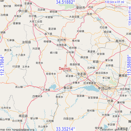
Daying GPS coordinates[2]
33° 56' 14.928" North, 112° 52' 58.656" East
| Map corner | latitude | longitude |
|---|---|---|
| Upper-left | 34.51882°, | 112.17984° |
| Center: | 33.93748°, | 112.88296° |
| Lower-right: | 33.35214°, | 113.58609° |
| Map W x H: | 129.7×129.7 km | = 80.6×80.6mi |
| max Lat: | 53.31946° ⇑30.2% North |
| Daying: | 33.93748° |
| min Lat: | ⇓69.8% South 18.22056° |
| min Long | Daying | max Long |
| 75.07348° | 112.88296° | 134.28917° |
| W 41.7%⇐ | ⇒58.3% E |
Elevation
Elevation of Daying is 224 m = 735 ft, and this is 260.8 m = 856 ft below average elevation for this country.
| Max E: |
5622 m = 18445 ft | 43.2% |
| Avg. | 484.8 m = 1591 ft | |
| Daying | 224 m = 735 ft | |
Min E: |
-3 m = -10 ft | 56.8% |
See also: China elevation on elevation.city.
Geographical zone
Daying is located in North temperate zone (between Tropic of Cancer and the Arctic Circle). Distance of this Northern Tropic circle is 1167.6 km =725.5 mi to South.| Distance of | km | miles | from Daying |
|---|---|---|---|
| North Pole | 6233.6 | 3873.4 | to North |
| Arctic Circle | 3627.7 | 2254.1 | to North |
| Tropic Cancer | 1167.6 | 725.5 | to South |
| Equator | 3773.5 | 2344.7 | to South |


Nearby cities:
15 places around Daying: (largest is in red/bold)
• Baofeng Chengguanzhen
18.4 km =11.4 mi,  113°
113°
• Cangtou
10.9 km =6.8 mi,  230°
230°
• Dongzhou
18.4 km =11.4 mi,  202°
202°
• Guanyinsi
16.3 km =10.1 mi,  241°
241°
• Liangwa
10.9 km =6.8 mi,  159°
159°
• Nanguzhuang
4.2 km =2.6 mi,  188°
188°
• Qianying
5.3 km =3.3 mi,  27°
27°
• Shangjiuwu
8.8 km =5.5 mi,  81°
81°
• Wawu
21.2 km =13.2 mi,  255°
255°
• Xiaoqi
16.6 km =10.3 mi,  98°
98°
• Xinji
19.7 km =12.2 mi,  146°
146°
• Xuedian
20.6 km =12.8 mi,  66°
66°
• Yangzhuang
18 km =11.2 mi,  128°
128°
• Zhangbaqiao
10.3 km =6.4 mi,  136°
136°
• Zhangdian
18.3 km =11.4 mi,  179°
179°
Sources, notices
• [Note1] Compared only with cities in China existing in our database
• [Src1] Map data: © OpenStreetMap contributors (CC-BY-SA)
• [Src2] Other city data from geonames.org with taken over terms of usage.
• [Src3] Geographical zone / Annual Mean Temperature by Robert A. Rohde @ Wikipedia
