Qilian geodata
Qilian (Qinghai) is a seat of a third-order administrative division; located in China in Asia/Shanghai (GMT+8) time zone. In our database, there are 1268 cities with bigger population. Compared to other cities in China, 81.2% of cities are located further ↓South; 94.4% of cities are located further →East and 96.4% of cities have lower elevation than Qilian. Note1
Administrative division(s):
- Level 1: Qinghai
- Level 2: Haibei Tibetan Autonomous Prefecture
- Level 3: Qilian County


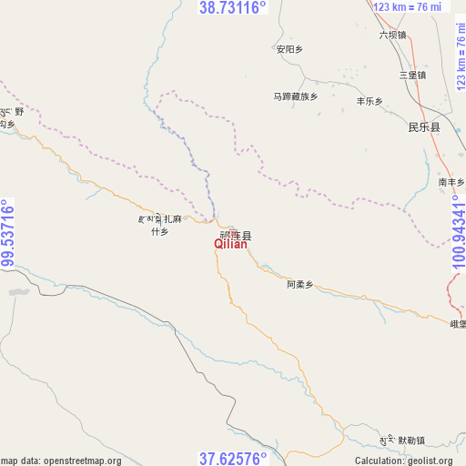
Qilian GPS coordinates[2]
38° 10' 50.016" North, 100° 14' 25.008" East
| Map corner | latitude | longitude |
|---|---|---|
| Upper-left | 38.73116°, | 99.53716° |
| Center: | 38.18056°, | 100.24028° |
| Lower-right: | 37.62576°, | 100.94341° |
| Map W x H: | 122.9×122.9 km | = 76.4×76.4mi |
| max Lat: | 53.31946° ⇑18.8% North |
| Qilian: | 38.18056° |
| min Lat: | ⇓81.2% South 18.22056° |
| min Long | Qilian | max Long |
| 75.07348° | 100.24028° | 134.28917° |
| W 5.6%⇐ | ⇒94.4% E |
Elevation
Elevation of Qilian is 2758 m = 9049 ft, and this is 2273.2 m = 7458 ft above average elevation for this country.
| Max E: |
5622 m = 18445 ft | 3.6% |
| Qilian | 2758 m 9049 ft | |
| Avg. | 484.8 m = 1591 ft | |
Min E: |
-3 m = -10 ft | 96.4% |
See also: China elevation on elevation.city.
Geographical zone
Qilian is located in North temperate zone (between Tropic of Cancer and the Arctic Circle). Distance of this Northern Tropic circle is 1639.4 km =1018.7 mi to South.| Distance of | km | miles | from Qilian |
|---|---|---|---|
| North Pole | 5761.8 | 3580.2 | to North |
| Arctic Circle | 3155.9 | 1961 | to North |
| Tropic Cancer | 1639.4 | 1018.7 | to South |
| Equator | 4245.3 | 2637.9 | to South |


Nearby cities:
15 places around Qilian: (largest is in red/bold)
• Hongshui
55.3 km =34.4 mi,  60°
60°
• Hongtu
65.1 km =40.5 mi,  111°
111°
• Huazhai
50.1 km =31.1 mi,  11°
11°
• Liuba
66.7 km =41.4 mi,  38°
38°
• Muri
69.2 km =43 mi,  142°
142°
• Nanfeng
58.1 km =36.1 mi,  75°
75°
• Nangu
44.2 km =27.5 mi,  25°
25°
• Obo
65.2 km =40.5 mi, 111°
• Sanbao
63 km =39.1 mi,  48°
48°
• Shunhua
52.3 km =32.5 mi, 52°
• Xintian
47.2 km =29.3 mi, 34°
• Xishui
51 km =31.7 mi,  353°
353°
• Yeniugou
68.7 km =42.7 mi,  293°
293°
• Yonggu
65.9 km =40.9 mi,  70°
70°
• Zamashi
19.9 km =12.4 mi,  277°
277°
Sources, notices
• [Note1] Compared only with cities in China existing in our database
• [Src1] Map data: © OpenStreetMap contributors (CC-BY-SA)
• [Src2] Other city data from geonames.org with taken over terms of usage.
• [Src3] Geographical zone / Annual Mean Temperature by Robert A. Rohde @ Wikipedia
