Muri geodata
Muri (Qinghai) is a seat of a fourth-order administrative division; located in China in Asia/Shanghai (GMT+8) time zone. In our database, there are 1268 cities with bigger population. Compared to other cities in China, 80.6% of cities are located further ↓South; 94% of cities are located further →East and 97.7% of cities have lower elevation than Muri. Note1


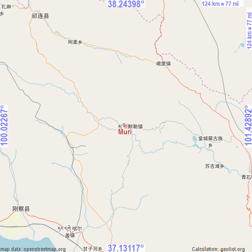
Muri GPS coordinates[2]
37° 41' 22.776" North, 100° 43' 32.844" East
| Map corner | latitude | longitude |
|---|---|---|
| Upper-left | 38.24398°, | 100.02267° |
| Center: | 37.68966°, | 100.72579° |
| Lower-right: | 37.13117°, | 101.42892° |
| Map W x H: | 123.7×123.7 km | = 76.9×76.9mi |
| max Lat: | 53.31946° ⇑19.4% North |
| Muri: | 37.68966° |
| min Lat: | ⇓80.6% South 18.22056° |
| min Long | Muri | max Long |
| 75.07348° | 100.72579° | 134.28917° |
| W 6%⇐ | ⇒94% E |
Elevation
Elevation of Muri is 3458 m = 11345 ft, and this is 2973.2 m = 9755 ft above average elevation for this country.
| Max E: |
5622 m = 18445 ft | 2.3% |
| Muri | 3458 m 11345 ft | |
| Avg. | 484.8 m = 1591 ft | |
Min E: |
-3 m = -10 ft | 97.7% |
See also: China elevation on elevation.city.
Geographical zone
Muri is located in North temperate zone (between Tropic of Cancer and the Arctic Circle). Distance of this Northern Tropic circle is 1584.8 km =984.7 mi to South.| Distance of | km | miles | from Muri |
|---|---|---|---|
| North Pole | 5816.4 | 3614.1 | to North |
| Arctic Circle | 3210.5 | 1994.9 | to North |
| Tropic Cancer | 1584.8 | 984.7 | to South |
| Equator | 4190.7 | 2604 | to South |


Nearby cities:
15 places around Muri: (largest is in red/bold)
• Damaying
86 km =53.4 mi,  28°
28°
• Hairag
58.6 km =36.4 mi,  207°
207°
• Hongshui
81.9 km =50.9 mi,  4°
4°
• Hongtu
35.9 km =22.3 mi, 30°
• Huangcheng
42.7 km =26.5 mi,  102°
102°
• Huocheng
84.4 km =52.4 mi,  19°
19°
• Nanfeng
70.8 km =44 mi,  11°
11°
• Obo
35.6 km =22.1 mi, 30°
• Qilian
69.2 km =43 mi,  322°
322°
• Qingshizui
67.1 km =41.7 mi,  111°
111°
• Shaliuhe
66 km =41 mi,  232°
232°
• Sujitan
45.7 km =28.4 mi, 114°
• Tuohua
67.7 km =42.1 mi,  183°
183°
• Yonggu
79.4 km =49.3 mi, 14°
• Zamashi
84.6 km =52.6 mi,  312°
312°
Sources, notices
• [Note1] Compared only with cities in China existing in our database
• [Src1] Map data: © OpenStreetMap contributors (CC-BY-SA)
• [Src2] Other city data from geonames.org with taken over terms of usage.
• [Src3] Geographical zone / Annual Mean Temperature by Robert A. Rohde @ Wikipedia
