Gangmian geodata
Gangmian (Jiangxi) is a seat of a fourth-order administrative division; located in China in Asia/Shanghai (GMT+8) time zone. In our database, there are 1268 cities with bigger population. Compared to other cities in China, 82% of cities are located further ↑North; 59.3% of cities are located further ←West and 55.2% of cities have lower elevation than Gangmian. Note1


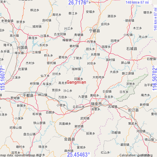
Gangmian GPS coordinates[2]
26° 5' 16.152" North, 115° 51' 50.004" East
| Map corner | latitude | longitude |
|---|---|---|
| Upper-left | 26.7176°, | 115.16077° |
| Center: | 26.08782°, | 115.86389° |
| Lower-right: | 25.45463°, | 116.56702° |
| Map W x H: | 140.4×140.4 km | = 87.2×87.2mi |
| max Lat: | 53.31946° ⇑82% North |
| Gangmian: | 26.08782° |
| min Lat: | ⇓18% South 18.22056° |
| min Long | Gangmian | max Long |
| 75.07348° | 115.86389° | 134.28917° |
| W 59.3%⇐ | ⇒40.7% E |
Elevation
Elevation of Gangmian is 208 m = 682 ft, and this is 276.8 m = 908 ft below average elevation for this country.
| Max E: |
5622 m = 18445 ft | 44.8% |
| Avg. | 484.8 m = 1591 ft | |
| Gangmian | 208 m = 682 ft | |
Min E: |
-3 m = -10 ft | 55.2% |
See also: China elevation on elevation.city.
Geographical zone
Gangmian is located in North temperate zone (between Tropic of Cancer and the Arctic Circle). Distance of this Northern Tropic circle is 294.8 km =183.2 mi to South.| Distance of | km | miles | from Gangmian |
|---|---|---|---|
| North Pole | 7106.4 | 4415.7 | to North |
| Arctic Circle | 4500.5 | 2796.5 | to North |
| Tropic Cancer | 294.8 | 183.2 | to South |
| Equator | 2900.7 | 1802.4 | to South |


Nearby cities:
15 places around Gangmian: (largest is in red/bold)
• Dabaidi
17.8 km =11.1 mi,  84°
84°
• Dingbei
19.1 km =11.9 mi,  356°
356°
• Duifang
18 km =11.2 mi,  39°
39°
• Fenkeng
20.3 km =12.6 mi,  282°
282°
• Gaolong
14.6 km =9.1 mi,  256°
256°
• Ge’ao
23.9 km =14.9 mi,  324°
324°
• Huangbai
20.5 km =12.7 mi,  136°
136°
• Huangshi
18.5 km =11.5 mi,  22°
22°
• Jiubao
16.2 km =10.1 mi,  166°
166°
• Kuantian
22.3 km =13.9 mi,  243°
243°
• Ruilin
9.1 km =5.7 mi,  345°
345°
• Shaxin
14.3 km =8.9 mi,  222°
222°
• Shazhouba
26 km =16.2 mi,  150°
150°
• Wantian
21.7 km =13.5 mi, 221°
• Yunshishan
24.9 km =15.5 mi,  180°
180°
Sources, notices
• [Note1] Compared only with cities in China existing in our database
• [Src1] Map data: © OpenStreetMap contributors (CC-BY-SA)
• [Src2] Other city data from geonames.org with taken over terms of usage.
• [Src3] Geographical zone / Annual Mean Temperature by Robert A. Rohde @ Wikipedia
