Wantian geodata
Wantian (Jiangxi) is a seat of a fourth-order administrative division; located in China in Asia/Shanghai (GMT+8) time zone. In our database, there are 1268 cities with bigger population. Compared to other cities in China, 82.6% of cities are located further ↑North; 58.3% of cities are located further ←West and 51.2% of cities have higher elevation than Wantian. Note1


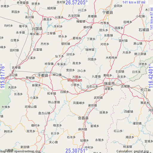
Wantian GPS coordinates[2]
25° 56' 29.328" North, 115° 43' 15.168" East
| Map corner | latitude | longitude |
|---|---|---|
| Upper-left | 26.57205°, | 115.01776° |
| Center: | 25.94148°, | 115.72088° |
| Lower-right: | 25.30751°, | 116.42401° |
| Map W x H: | 140.6×140.6 km | = 87.4×87.4mi |
| max Lat: | 53.31946° ⇑82.6% North |
| Wantian: | 25.94148° |
| min Lat: | ⇓17.4% South 18.22056° |
| min Long | Wantian | max Long |
| 75.07348° | 115.72088° | 134.28917° |
| W 58.3%⇐ | ⇒41.7% E |
Elevation
Elevation of Wantian is 155 m = 509 ft, and this is 329.8 m = 1082 ft below average elevation for this country.
| Max E: |
5622 m = 18445 ft | 51.2% |
| Avg. | 484.8 m = 1591 ft | |
| Wantian | 155 m = 509 ft | |
Min E: |
-3 m = -10 ft | 48.8% |
See also: China elevation on elevation.city.
Geographical zone
Wantian is located in North temperate zone (between Tropic of Cancer and the Arctic Circle). Distance of this Northern Tropic circle is 278.5 km =173.1 mi to South.| Distance of | km | miles | from Wantian |
|---|---|---|---|
| North Pole | 7122.6 | 4425.8 | to North |
| Arctic Circle | 4516.8 | 2806.6 | to North |
| Tropic Cancer | 278.5 | 173.1 | to South |
| Equator | 2884.4 | 1792.3 | to South |


Nearby cities:
15 places around Wantian: (largest is in red/bold)
• Bai’e
17.6 km =10.9 mi,  219°
219°
• Chexi
18.3 km =11.4 mi,  310°
310°
• Fenghuangdong
23.9 km =14.9 mi,  175°
175°
• Fenkeng
21.5 km =13.4 mi,  345°
345°
• Gangmian
21.7 km =13.5 mi,  41°
41°
• Gaolong
12.8 km =8 mi,  0°
0°
• Huanglin
10.3 km =6.4 mi,  255°
255°
• Jiubao
18 km =11.2 mi,  88°
88°
• Kuantian
8.6 km =5.3 mi,  317°
317°
• Shaxin
7.3 km =4.5 mi, 38°
• Xiaomi
7.4 km =4.6 mi,  191°
191°
• Xijiang
13 km =8.1 mi,  152°
152°
• Yunshishan
16.6 km =10.3 mi,  121°
121°
• Zhuangkou
23.5 km =14.6 mi,  196°
196°
• Zishan
18.1 km =11.2 mi,  276°
276°
Sources, notices
• [Note1] Compared only with cities in China existing in our database
• [Src1] Map data: © OpenStreetMap contributors (CC-BY-SA)
• [Src2] Other city data from geonames.org with taken over terms of usage.
• [Src3] Geographical zone / Annual Mean Temperature by Robert A. Rohde @ Wikipedia
