Chengdong geodata
Chengdong (Fujian) is a seat of a fourth-order administrative division; located in China in Asia/Shanghai (GMT+8) time zone. In our database, there are 1268 cities with bigger population. Compared to other cities in China, 81.4% of cities are located further ↑North; 69.2% of cities are located further ←West and 53.7% of cities have higher elevation than Chengdong. Note1


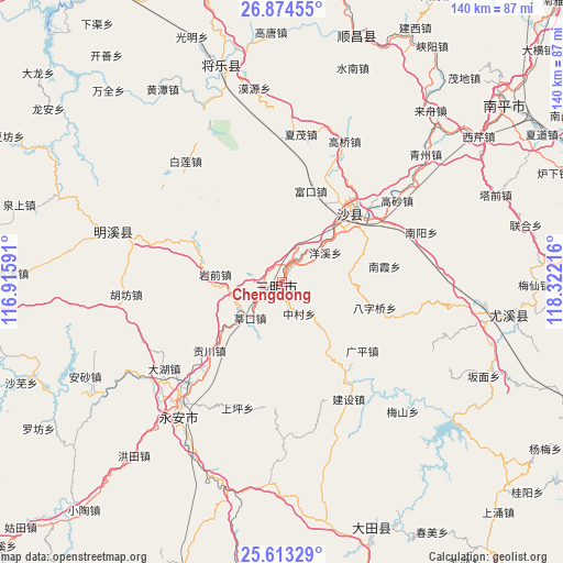
Chengdong GPS coordinates[2]
26° 14' 44.268" North, 117° 37' 8.508" East
| Map corner | latitude | longitude |
|---|---|---|
| Upper-left | 26.87455°, | 116.91591° |
| Center: | 26.24563°, | 117.61903° |
| Lower-right: | 25.61329°, | 118.32216° |
| Map W x H: | 140.2×140.2 km | = 87.1×87.1mi |
| max Lat: | 53.31946° ⇑81.4% North |
| Chengdong: | 26.24563° |
| min Lat: | ⇓18.6% South 18.22056° |
| min Long | Chengdong | max Long |
| 75.07348° | 117.61903° | 134.28917° |
| W 69.2%⇐ | ⇒30.8% E |
Elevation
Elevation of Chengdong is 139 m = 456 ft, and this is 345.8 m = 1135 ft below average elevation for this country.
| Max E: |
5622 m = 18445 ft | 53.7% |
| Avg. | 484.8 m = 1591 ft | |
| Chengdong | 139 m = 456 ft | |
Min E: |
-3 m = -10 ft | 46.3% |
See also: China elevation on elevation.city.
Geographical zone
Chengdong is located in North temperate zone (between Tropic of Cancer and the Arctic Circle). Distance of this Northern Tropic circle is 312.3 km =194.1 mi to South.| Distance of | km | miles | from Chengdong |
|---|---|---|---|
| North Pole | 7088.8 | 4404.8 | to North |
| Arctic Circle | 4482.9 | 2785.5 | to North |
| Tropic Cancer | 312.3 | 194.1 | to South |
| Equator | 2918.2 | 1813.3 | to South |


Nearby cities:
15 places around Chengdong: (largest is in red/bold)
• Baziqiao
23.9 km =14.9 mi,  105°
105°
• Chenda
8 km =5 mi,  18°
18°
• Daluo
17 km =10.6 mi,  87°
87°
• Fukou
23.7 km =14.7 mi, 17°
• Gongchuan
24.9 km =15.5 mi,  226°
226°
• Huyuan
19.8 km =12.3 mi,  130°
130°
• Jingxi
9.3 km =5.8 mi, 232°
• Nanxia
25.8 km =16 mi,  81°
81°
• Qiujiang
22.6 km =14 mi,  43°
43°
• Sanming
0.3 km =0.2 mi,  352°
352°
• Shenkou
12.2 km =7.6 mi,  222°
222°
• Xubi
4 km =2.5 mi, 19°
• Yangxi
13 km =8.1 mi,  55°
55°
• Yanqian
16.8 km =10.4 mi,  276°
276°
• Zhongcun
8.9 km =5.5 mi,  151°
151°
Sources, notices
• [Note1] Compared only with cities in China existing in our database
• [Src1] Map data: © OpenStreetMap contributors (CC-BY-SA)
• [Src2] Other city data from geonames.org with taken over terms of usage.
• [Src3] Geographical zone / Annual Mean Temperature by Robert A. Rohde @ Wikipedia
