Yangxi geodata
Yangxi (Fujian) is a seat of a fourth-order administrative division; located in China in Asia/Shanghai (GMT+8) time zone. In our database, there are 1268 cities with bigger population. Compared to other cities in China, 81.2% of cities are located further ↑North; 69.6% of cities are located further ←West and 56.4% of cities have lower elevation than Yangxi. Note1


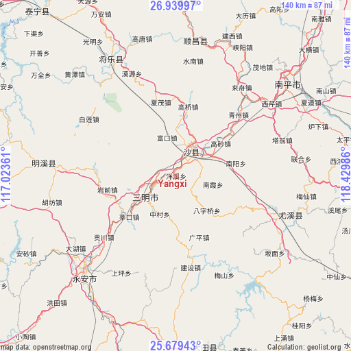
Yangxi GPS coordinates[2]
26° 18' 41.076" North, 117° 43' 36.228" East
| Map corner | latitude | longitude |
|---|---|---|
| Upper-left | 26.93997°, | 117.02361° |
| Center: | 26.31141°, | 117.72673° |
| Lower-right: | 25.67943°, | 118.42986° |
| Map W x H: | 140.2×140.2 km | = 87.1×87.1mi |
| max Lat: | 53.31946° ⇑81.2% North |
| Yangxi: | 26.31141° |
| min Lat: | ⇓18.8% South 18.22056° |
| min Long | Yangxi | max Long |
| 75.07348° | 117.72673° | 134.28917° |
| W 69.6%⇐ | ⇒30.4% E |
Elevation
Elevation of Yangxi is 220 m = 722 ft, and this is 264.8 m = 869 ft below average elevation for this country.
| Max E: |
5622 m = 18445 ft | 43.6% |
| Avg. | 484.8 m = 1591 ft | |
| Yangxi | 220 m = 722 ft | |
Min E: |
-3 m = -10 ft | 56.4% |
See also: China elevation on elevation.city.
Geographical zone
Yangxi is located in North temperate zone (between Tropic of Cancer and the Arctic Circle). Distance of this Northern Tropic circle is 319.6 km =198.6 mi to South.| Distance of | km | miles | from Yangxi |
|---|---|---|---|
| North Pole | 7081.5 | 4400.2 | to North |
| Arctic Circle | 4475.6 | 2781 | to North |
| Tropic Cancer | 319.6 | 198.6 | to South |
| Equator | 2925.6 | 1817.9 | to South |


Nearby cities:
15 places around Yangxi: (largest is in red/bold)
• Baziqiao
18.4 km =11.4 mi,  138°
138°
• Chenda
8.2 km =5.1 mi,  272°
272°
• Chengdong
13 km =8.1 mi,  235°
235°
• Daluo
9.2 km =5.7 mi, 137°
• Fukou
15.7 km =9.8 mi,  346°
346°
• Gaosha
22 km =13.7 mi,  54°
54°
• Huyuan
20.7 km =12.9 mi,  168°
168°
• Jingxi
22.3 km =13.9 mi,  234°
234°
• Langkou
14.1 km =8.8 mi, 53°
• Nankengzai
15.9 km =9.9 mi,  101°
101°
• Nanxia
15.1 km =9.4 mi, 102°
• Qiujiang
10.2 km =6.3 mi,  27°
27°
• Sanming
12.8 km =8 mi, 237°
• Xubi
10 km =6.2 mi,  249°
249°
• Zhongcun
16.5 km =10.3 mi,  203°
203°
Sources, notices
• [Note1] Compared only with cities in China existing in our database
• [Src1] Map data: © OpenStreetMap contributors (CC-BY-SA)
• [Src2] Other city data from geonames.org with taken over terms of usage.
• [Src3] Geographical zone / Annual Mean Temperature by Robert A. Rohde @ Wikipedia
