Fukou geodata
Fukou (Fujian) is a seat of a fourth-order administrative division; located in China in Asia/Shanghai (GMT+8) time zone. In our database, there are 1268 cities with bigger population. Compared to other cities in China, 80.6% of cities are located further ↑North; 69.4% of cities are located further ←West and 52.7% of cities have lower elevation than Fukou. Note1


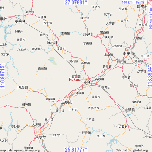
Fukou GPS coordinates[2]
26° 26' 56.436" North, 117° 41' 24.972" East
| Map corner | latitude | longitude |
|---|---|---|
| Upper-left | 27.07681°, | 116.98715° |
| Center: | 26.44901°, | 117.69027° |
| Lower-right: | 25.81777°, | 118.3934° |
| Map W x H: | 140×140 km | = 87×87mi |
| max Lat: | 53.31946° ⇑80.6% North |
| Fukou: | 26.44901° |
| min Lat: | ⇓19.4% South 18.22056° |
| min Long | Fukou | max Long |
| 75.07348° | 117.69027° | 134.28917° |
| W 69.4%⇐ | ⇒30.6% E |
Elevation
Elevation of Fukou is 186 m = 610 ft, and this is 298.8 m = 980 ft below average elevation for this country.
| Max E: |
5622 m = 18445 ft | 47.3% |
| Avg. | 484.8 m = 1591 ft | |
| Fukou | 186 m = 610 ft | |
Min E: |
-3 m = -10 ft | 52.7% |
See also: China elevation on elevation.city.
Geographical zone
Fukou is located in North temperate zone (between Tropic of Cancer and the Arctic Circle). Distance of this Northern Tropic circle is 334.9 km =208.1 mi to South.| Distance of | km | miles | from Fukou |
|---|---|---|---|
| North Pole | 7066.2 | 4390.7 | to North |
| Arctic Circle | 4460.3 | 2771.5 | to North |
| Tropic Cancer | 334.9 | 208.1 | to South |
| Equator | 2940.9 | 1827.4 | to South |


Nearby cities:
15 places around Fukou: (largest is in red/bold)
• Chenda
15.7 km =9.8 mi,  196°
196°
• Chengdong
23.7 km =14.7 mi, 197°
• Daluo
24.1 km =15 mi,  155°
155°
• Gaoqiao
15 km =9.3 mi,  34°
34°
• Gaosha
21.6 km =13.4 mi,  96°
96°
• Langkou
16.4 km =10.2 mi,  114°
114°
• Lishu
16.3 km =10.1 mi,  9°
9°
• Nankengzai
26.6 km =16.5 mi,  133°
133°
• Nanxia
26.2 km =16.3 mi,  135°
135°
• Qiujiang
10.5 km =6.5 mi, 126°
• Sanming
23.4 km =14.5 mi, 197°
• Xiamao
14.4 km =8.9 mi,  350°
350°
• Xiayang
23.6 km =14.7 mi,  264°
264°
• Xubi
19.7 km =12.2 mi, 196°
• Yangxi
15.7 km =9.8 mi,  166°
166°
Sources, notices
• [Note1] Compared only with cities in China existing in our database
• [Src1] Map data: © OpenStreetMap contributors (CC-BY-SA)
• [Src2] Other city data from geonames.org with taken over terms of usage.
• [Src3] Geographical zone / Annual Mean Temperature by Robert A. Rohde @ Wikipedia
