Chengjiao Chengguanzhen geodata
Chengjiao Chengguanzhen (Gansu) is a seat of a third-order administrative division; located in China in Asia/Shanghai (GMT+8) time zone. In our database, there are 1268 cities with bigger population. Compared to other cities in China, 72.4% of cities are located further ↓South; 90.2% of cities are located further →East and 95.5% of cities have lower elevation than Chengjiao Chengguanzhen. Note1
Current local time in Chengjiao Chengguanzhen:
03:33 PM, TuesdayDifference from your time zone: hours


Chengjiao Chengguanzhen GPS coordinates[2]
34° 26' 8.988" North, 104° 1' 50.016" East
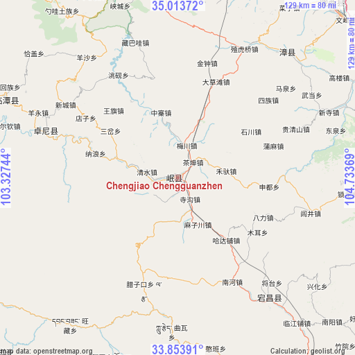
| Map corner | latitude | longitude |
|---|---|---|
| Upper-left | 35.01372°, | 103.32744° |
| Center: | 34.43583°, | 104.03056° |
| Lower-right: | 33.85391°, | 104.73369° |
| Map W x H: | 129×129 km | = 80.2×80.2mi |
| max Lat: | 53.31946° ⇑27.6% North |
| Chengjiao Chengguanzhen: | 34.43583° |
| min Lat: | ⇓72.4% South 18.22056° |
| min Long | Chengjiao Cheng | max Long |
| 75.07348° | 104.03056° | 134.28917° |
| W 9.8%⇐ | ⇒90.2% E |
Elevation
Elevation of Chengjiao Chengguanzhen is 2316 m = 7598 ft, and this is 1831.2 m = 6008 ft above average elevation for this country.
| Max E: |
5622 m = 18445 ft | 4.5% |
| Chengjiao Chengguanzhen | 2316 m 7598 ft | |
| Avg. | 484.8 m = 1591 ft | |
Min E: |
-3 m = -10 ft | 95.5% |
See also: China elevation on elevation.city.
Geographical zone
Chengjiao Chengguanzhen is located in North temperate zone (between Tropic of Cancer and the Arctic Circle). Distance of this Northern Tropic circle is 1223 km =759.9 mi to South.| Distance of | km | miles | from Chengjiao Chengguanzhen |
|---|---|---|---|
| North Pole | 6178.2 | 3839 | to North |
| Arctic Circle | 3572.3 | 2219.7 | to North |
| Tropic Cancer | 1223 | 759.9 | to South |
| Equator | 3828.9 | 2379.2 | to South |


Nearby cities:
15 places around Chengjiao Chengguanzhen: (largest is in red/bold)
• Baozi
29.6 km =18.4 mi,  332°
332°
• Chabu
8.2 km =5.1 mi,  46°
46°
• Chengjiao Zhen
0.9 km =0.6 mi,  94°
94°
• Hadapu Zhen
28.8 km =17.9 mi,  142°
142°
• Meichuan Zhen
12 km =7.5 mi,  14°
14°
• Minshan
5 km =3.1 mi,  271°
271°
• Qingshui
12 km =7.5 mi,  282°
282°
• Qinxu
8.3 km =5.2 mi,  203°
203°
• Shili
7.2 km =4.5 mi,  258°
258°
• Sigou
9 km =5.6 mi,  150°
150°
• Weixin
29.7 km =18.5 mi, 330°
• Xiaozhai
22.7 km =14.1 mi,  355°
355°
• Xijiang
14.7 km =9.1 mi,  350°
350°
• Xizhai
21.9 km =13.6 mi,  287°
287°
• Zhongzhai
24.4 km =15.2 mi, 345°
Sources, notices
• [Note1] Compared only with cities in China existing in our database
• [Src1] Map data: © OpenStreetMap contributors (CC-BY-SA)
• [Src2] Other city data from geonames.org with taken over terms of usage.
• [Src3] Geographical zone / Annual Mean Temperature by Robert A. Rohde @ Wikipedia
