Chabu geodata
Chabu (Gansu) is a seat of a fourth-order administrative division; located in China in Asia/Shanghai (GMT+8) time zone. In our database, there are 1268 cities with bigger population. Compared to other cities in China, 72.7% of cities are located further ↓South; 90.2% of cities are located further →East and 95.5% of cities have lower elevation than Chabu. Note1


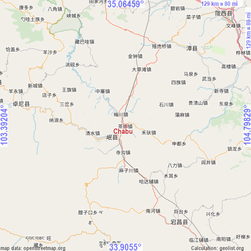
Chabu GPS coordinates[2]
34° 29' 13.416" North, 104° 5' 42.576" East
| Map corner | latitude | longitude |
|---|---|---|
| Upper-left | 35.06459°, | 103.39204° |
| Center: | 34.48706°, | 104.09516° |
| Lower-right: | 33.9055°, | 104.79829° |
| Map W x H: | 128.9×128.9 km | = 80.1×80.1mi |
| max Lat: | 53.31946° ⇑27.3% North |
| Chabu: | 34.48706° |
| min Lat: | ⇓72.7% South 18.22056° |
| min Long | Chabu | max Long |
| 75.07348° | 104.09516° | 134.28917° |
| W 9.8%⇐ | ⇒90.2% E |
Elevation
Elevation of Chabu is 2307 m = 7569 ft, and this is 1822.2 m = 5978 ft above average elevation for this country.
| Max E: |
5622 m = 18445 ft | 4.5% |
| Chabu | 2307 m 7569 ft | |
| Avg. | 484.8 m = 1591 ft | |
Min E: |
-3 m = -10 ft | 95.5% |
See also: China elevation on elevation.city.
Geographical zone
Chabu is located in North temperate zone (between Tropic of Cancer and the Arctic Circle). Distance of this Northern Tropic circle is 1228.7 km =763.5 mi to South.| Distance of | km | miles | from Chabu |
|---|---|---|---|
| North Pole | 6172.5 | 3835.4 | to North |
| Arctic Circle | 3566.6 | 2216.2 | to North |
| Tropic Cancer | 1228.7 | 763.5 | to South |
| Equator | 3834.6 | 2382.7 | to South |


Nearby cities:
15 places around Chabu: (largest is in red/bold)
• Baozi
28.4 km =17.6 mi,  316°
316°
• Chengjiao Chengguanzhen
8.2 km =5.1 mi,  226°
226°
• Chengjiao Zhen
7.7 km =4.8 mi,  221°
221°
• Hadapu Zhen
30.8 km =19.1 mi,  157°
157°
• Meichuan Zhen
6.6 km =4.1 mi,  334°
334°
• Minshan
12.3 km =7.6 mi,  243°
243°
• Qingshui
17.9 km =11.1 mi,  260°
260°
• Qinxu
16.2 km =10.1 mi,  214°
214°
• Shili
14.8 km =9.2 mi, 241°
• Sigou
13.6 km =8.5 mi,  186°
186°
• Weixin
28.8 km =17.9 mi,  313°
313°
• Xiaozhai
18.5 km =11.5 mi,  336°
336°
• Xijiang
12.1 km =7.5 mi, 316°
• Xizhai
26.9 km =16.7 mi,  271°
271°
• Zhongzhai
21.6 km =13.4 mi, 326°
Sources, notices
• [Note1] Compared only with cities in China existing in our database
• [Src1] Map data: © OpenStreetMap contributors (CC-BY-SA)
• [Src2] Other city data from geonames.org with taken over terms of usage.
• [Src3] Geographical zone / Annual Mean Temperature by Robert A. Rohde @ Wikipedia
