Xiangyang geodata
Xiangyang (Heilongjiang) is a seat of a fourth-order administrative division; located in China in Asia/Shanghai (GMT+8) time zone. In our database, there are 1268 cities with bigger population. Compared to other cities in China, 94.7% of cities are located further ↓South; 96.5% of cities are located further ←West and 52.4% of cities have higher elevation than Xiangyang. Note1


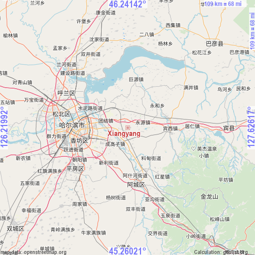
Xiangyang GPS coordinates[2]
45° 45' 10.692" North, 126° 55' 22.944" East
| Map corner | latitude | longitude |
|---|---|---|
| Upper-left | 46.24142°, | 126.21992° |
| Center: | 45.75297°, | 126.92304° |
| Lower-right: | 45.26021°, | 127.62617° |
| Map W x H: | 109.1×109.1 km | = 67.8×67.8mi |
| max Lat: | 53.31946° ⇑5.3% North |
| Xiangyang: | 45.75297° |
| min Lat: | ⇓94.7% South 18.22056° |
| min Long | Xiangyang | max Long |
| 75.07348° | 126.92304° | 134.28917° |
| W 96.5%⇐ | ⇒3.5% E |
Elevation
Elevation of Xiangyang is 147 m = 482 ft, and this is 337.8 m = 1108 ft below average elevation for this country.
| Max E: |
5622 m = 18445 ft | 52.4% |
| Avg. | 484.8 m = 1591 ft | |
| Xiangyang | 147 m = 482 ft | |
Min E: |
-3 m = -10 ft | 47.6% |
See also: China elevation on elevation.city.
Geographical zone
Xiangyang is located in North temperate zone (between Tropic of Cancer and the Arctic Circle). Distance of this North polar circle is 2313.9 km =1437.8 mi to North.| Distance of | km | miles | from Xiangyang |
|---|---|---|---|
| North Pole | 4919.8 | 3057 | to North |
| Arctic Circle | 2313.9 | 1437.8 | to North |
| Tropic Cancer | 2481.3 | 1541.8 | to South |
| Equator | 5087.3 | 3161.1 | to South |


Nearby cities:
15 places around Xiangyang: (largest is in red/bold)
• Acheng
23.5 km =14.6 mi,  169°
169°
• Ashihe
24.5 km =15.2 mi, 170°
• Binxi
18.1 km =11.2 mi,  91°
91°
• Daling
31.1 km =19.3 mi,  151°
151°
• Feiketu
17.2 km =10.7 mi, 92°
• Harbin
21.2 km =13.2 mi,  269°
269°
• Hongxing
25.4 km =15.8 mi,  144°
144°
• Juren
27.7 km =17.2 mi, 88°
• Juyuan
21.3 km =13.2 mi,  10°
10°
• Liaodian
16.8 km =10.4 mi, 142°
• Sheli
21 km =13 mi,  178°
178°
• Tangfang
20.3 km =12.6 mi,  30°
30°
• Yonghe
16 km =9.9 mi,  52°
52°
• Yonghe
16.5 km =10.3 mi,  59°
59°
• Yongyuan
7 km =4.3 mi,  70°
70°
Sources, notices
• [Note1] Compared only with cities in China existing in our database
• [Src1] Map data: © OpenStreetMap contributors (CC-BY-SA)
• [Src2] Other city data from geonames.org with taken over terms of usage.
• [Src3] Geographical zone / Annual Mean Temperature by Robert A. Rohde @ Wikipedia
