Niaohe geodata
Niaohe (Heilongjiang) is a seat of a fourth-order administrative division; located in China in Asia/Shanghai (GMT+8) time zone. In our database, there are 1268 cities with bigger population. Compared to other cities in China, 94.9% of cities are located further ↓South; 97.5% of cities are located further ←West and 50.4% of cities have lower elevation than Niaohe. Note1


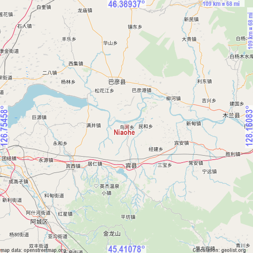
Niaohe GPS coordinates[2]
45° 54' 8.028" North, 127° 27' 27.72" East
| Map corner | latitude | longitude |
|---|---|---|
| Upper-left | 46.38937°, | 126.75458° |
| Center: | 45.90223°, | 127.4577° |
| Lower-right: | 45.41078°, | 128.16083° |
| Map W x H: | 108.8×108.8 km | = 67.6×67.6mi |
| max Lat: | 53.31946° ⇑5.1% North |
| Niaohe: | 45.90223° |
| min Lat: | ⇓94.9% South 18.22056° |
| min Long | Niaohe | max Long |
| 75.07348° | 127.4577° | 134.28917° |
| W 97.5%⇐ | ⇒2.5% E |
Elevation
Elevation of Niaohe is 168 m = 551 ft, and this is 316.8 m = 1039 ft below average elevation for this country.
| Max E: |
5622 m = 18445 ft | 49.6% |
| Avg. | 484.8 m = 1591 ft | |
| Niaohe | 168 m = 551 ft | |
Min E: |
-3 m = -10 ft | 50.4% |
See also: China elevation on elevation.city.
Geographical zone
Niaohe is located in North temperate zone (between Tropic of Cancer and the Arctic Circle). Distance of this North polar circle is 2297.3 km =1427.5 mi to North.| Distance of | km | miles | from Niaohe |
|---|---|---|---|
| North Pole | 4903.2 | 3046.7 | to North |
| Arctic Circle | 2297.3 | 1427.5 | to North |
| Tropic Cancer | 2497.9 | 1552.1 | to South |
| Equator | 5103.8 | 3171.4 | to South |


Nearby cities:
15 places around Niaohe: (largest is in red/bold)
• Bayan
19.8 km =12.3 mi,  346°
346°
• Bayangang
16.9 km =10.5 mi,  22°
22°
• Binxi
28.9 km =18 mi,  233°
233°
• Binzhou
16.7 km =10.4 mi,  174°
174°
• Bin’an
24.4 km =15.2 mi,  106°
106°
• Fujiang
14.5 km =9 mi,  359°
359°
• Jingjian
15.9 km =9.9 mi,  126°
126°
• Juren
20.9 km =13 mi,  221°
221°
• Liuhe
23.6 km =14.7 mi,  58°
58°
• Manjing
14.4 km =8.9 mi,  273°
273°
• Minhe
8.1 km =5 mi,  87°
87°
• Sanbao
23 km =14.3 mi, 134°
• Songhuajiang
18.2 km =11.3 mi,  325°
325°
• Xindian
28.5 km =17.7 mi, 86°
• Yonghe
28.4 km =17.6 mi,  253°
253°
Sources, notices
• [Note1] Compared only with cities in China existing in our database
• [Src1] Map data: © OpenStreetMap contributors (CC-BY-SA)
• [Src2] Other city data from geonames.org with taken over terms of usage.
• [Src3] Geographical zone / Annual Mean Temperature by Robert A. Rohde @ Wikipedia
