Huayuan geodata
Huayuan (Jiangxi) is a seat of a fourth-order administrative division; located in China in Asia/Shanghai (GMT+8) time zone. In our database, there are 1268 cities with bigger population. Compared to other cities in China, 58.6% of cities are located further ↑North; 55.9% of cities are located further ←West and 53.8% of cities have higher elevation than Huayuan. Note1


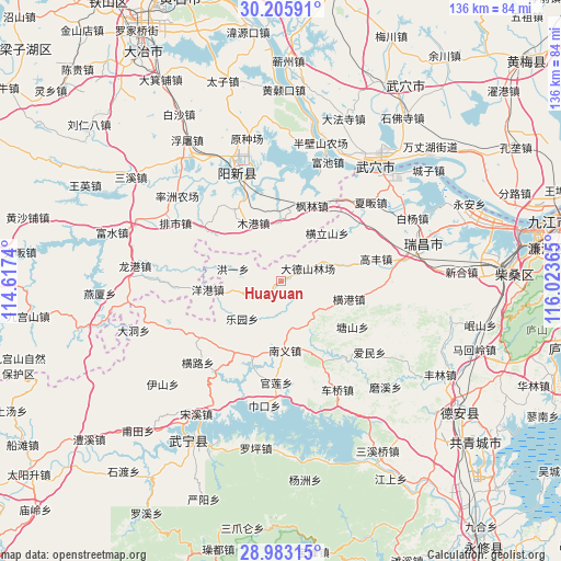
Huayuan GPS coordinates[2]
29° 35' 46.968" North, 115° 19' 13.872" East
| Map corner | latitude | longitude |
|---|---|---|
| Upper-left | 30.20591°, | 114.6174° |
| Center: | 29.59638°, | 115.32052° |
| Lower-right: | 28.98315°, | 116.02365° |
| Map W x H: | 136×136 km | = 84.5×84.5mi |
| max Lat: | 53.31946° ⇑58.6% North |
| Huayuan: | 29.59638° |
| min Lat: | ⇓41.4% South 18.22056° |
| min Long | Huayuan | max Long |
| 75.07348° | 115.32052° | 134.28917° |
| W 55.9%⇐ | ⇒44.1% E |
Elevation
Elevation of Huayuan is 138 m = 453 ft, and this is 346.8 m = 1138 ft below average elevation for this country.
| Max E: |
5622 m = 18445 ft | 53.8% |
| Avg. | 484.8 m = 1591 ft | |
| Huayuan | 138 m = 453 ft | |
Min E: |
-3 m = -10 ft | 46.2% |
See also: China elevation on elevation.city.
Geographical zone
Huayuan is located in North temperate zone (between Tropic of Cancer and the Arctic Circle). Distance of this Northern Tropic circle is 684.9 km =425.6 mi to South.| Distance of | km | miles | from Huayuan |
|---|---|---|---|
| North Pole | 6716.3 | 4173.3 | to North |
| Arctic Circle | 4110.4 | 2554.1 | to North |
| Tropic Cancer | 684.9 | 425.6 | to South |
| Equator | 3290.8 | 2044.8 | to South |


Nearby cities:
15 places around Huayuan: (largest is in red/bold)
• Fanzhen
23.6 km =14.7 mi,  93°
93°
• Fenglin
19.7 km =12.2 mi,  21°
21°
• Gaofeng
23.3 km =14.5 mi,  77°
77°
• Henggang
16.8 km =10.4 mi,  105°
105°
• Henglishan
16 km =9.9 mi,  43°
43°
• Hongyi
12.1 km =7.5 mi,  284°
284°
• Leshan
14.8 km =9.2 mi, 91°
• Leyuan
13.4 km =8.3 mi,  227°
227°
• Luxi
19.9 km =12.4 mi,  205°
205°
• Mugang
15.8 km =9.8 mi,  333°
333°
• Nanyi
16.5 km =10.3 mi,  178°
178°
• Neihu
15.9 km =9.9 mi,  31°
31°
• Tangshan
20.4 km =12.7 mi,  123°
123°
• Yanggang
17.8 km =11.1 mi,  263°
263°
• Zhaochen
13.1 km =8.1 mi, 263°
Sources, notices
• [Note1] Compared only with cities in China existing in our database
• [Src1] Map data: © OpenStreetMap contributors (CC-BY-SA)
• [Src2] Other city data from geonames.org with taken over terms of usage.
• [Src3] Geographical zone / Annual Mean Temperature by Robert A. Rohde @ Wikipedia
