Yantianhe geodata
Yantianhe (Hubei) is a seat of a fourth-order administrative division; located in China in Asia/Shanghai (GMT+8) time zone. In our database, there are 1268 cities with bigger population. Compared to other cities in China, 54.6% of cities are located further ↓South; 55.2% of cities are located further ←West and 50.9% of cities have higher elevation than Yantianhe. Note1


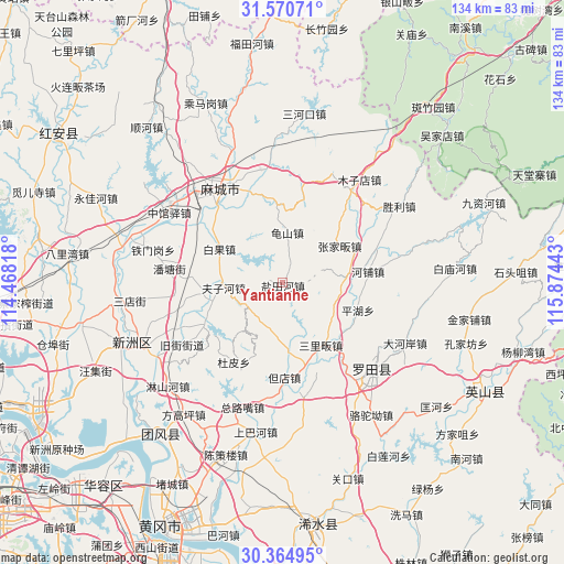
Yantianhe GPS coordinates[2]
30° 58' 11.028" North, 115° 10' 16.68" East
| Map corner | latitude | longitude |
|---|---|---|
| Upper-left | 31.57071°, | 114.46818° |
| Center: | 30.96973°, | 115.1713° |
| Lower-right: | 30.36495°, | 115.87443° |
| Map W x H: | 134.1×134.1 km | = 83.3×83.3mi |
| max Lat: | 53.31946° ⇑45.4% North |
| Yantianhe: | 30.96973° |
| min Lat: | ⇓54.6% South 18.22056° |
| min Long | Yantianhe | max Long |
| 75.07348° | 115.1713° | 134.28917° |
| W 55.2%⇐ | ⇒44.8% E |
Elevation
Elevation of Yantianhe is 157 m = 515 ft, and this is 327.8 m = 1075 ft below average elevation for this country.
| Max E: |
5622 m = 18445 ft | 50.9% |
| Avg. | 484.8 m = 1591 ft | |
| Yantianhe | 157 m = 515 ft | |
Min E: |
-3 m = -10 ft | 49.1% |
See also: China elevation on elevation.city.
Geographical zone
Yantianhe is located in North temperate zone (between Tropic of Cancer and the Arctic Circle). Distance of this Northern Tropic circle is 837.6 km =520.5 mi to South.| Distance of | km | miles | from Yantianhe |
|---|---|---|---|
| North Pole | 6563.6 | 4078.4 | to North |
| Arctic Circle | 3957.7 | 2459.2 | to North |
| Tropic Cancer | 837.6 | 520.5 | to South |
| Equator | 3443.5 | 2139.7 | to South |


Nearby cities:
15 places around Yantianhe: (largest is in red/bold)
• Baiguo
16.9 km =10.5 mi,  297°
297°
• Dandian
22.5 km =14 mi,  178°
178°
• Daqi
13.1 km =8.1 mi,  171°
171°
• Dupi
22.5 km =14 mi,  210°
210°
• Fengshan
25.5 km =15.8 mi,  111°
111°
• Fuzihe
14.1 km =8.8 mi,  264°
264°
• Guishan
11.8 km =7.3 mi,  4°
4°
• Gulou
26.6 km =16.5 mi,  330°
330°
• Hepu
20.3 km =12.6 mi,  82°
82°
• Jiamiao
21.1 km =13.1 mi,  203°
203°
• Pantang
27.2 km =16.9 mi,  276°
276°
• Pinghu
19.1 km =11.9 mi, 110°
• Sanlifan
17.5 km =10.9 mi,  148°
148°
• Xugu
19.5 km =12.1 mi, 263°
• Zhangjiafan
16.1 km =10 mi,  56°
56°
Sources, notices
• [Note1] Compared only with cities in China existing in our database
• [Src1] Map data: © OpenStreetMap contributors (CC-BY-SA)
• [Src2] Other city data from geonames.org with taken over terms of usage.
• [Src3] Geographical zone / Annual Mean Temperature by Robert A. Rohde @ Wikipedia
