Jinsheng geodata
Jinsheng (Chongqing) is a seat of a fourth-order administrative division; located in China in Asia/Shanghai (GMT+8) time zone. In our database, there are 1268 cities with bigger population. Compared to other cities in China, 50.6% of cities are located further ↓South; 80.6% of cities are located further →East and 78.6% of cities have lower elevation than Jinsheng. Note1


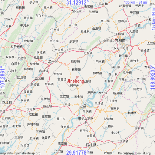
Jinsheng GPS coordinates[2]
30° 31' 31.224" North, 107° 59' 21.192" East
| Map corner | latitude | longitude |
|---|---|---|
| Upper-left | 31.12912°, | 107.2861° |
| Center: | 30.52534°, | 107.98922° |
| Lower-right: | 29.91778°, | 108.69235° |
| Map W x H: | 134.7×134.7 km | = 83.7×83.7mi |
| max Lat: | 53.31946° ⇑49.4% North |
| Jinsheng: | 30.52534° |
| min Lat: | ⇓50.6% South 18.22056° |
| min Long | Jinsheng | max Long |
| 75.07348° | 107.98922° | 134.28917° |
| W 19.4%⇐ | ⇒80.6% E |
Elevation
Elevation of Jinsheng is 636 m = 2087 ft, and this is 151.2 m = 496 ft above average elevation for this country.
| Max E: |
5622 m = 18445 ft | 21.4% |
| Jinsheng | 636 m 2087 ft | |
| Avg. | 484.8 m = 1591 ft | |
Min E: |
-3 m = -10 ft | 78.6% |
See also: China elevation on elevation.city.
Geographical zone
Jinsheng is located in North temperate zone (between Tropic of Cancer and the Arctic Circle). Distance of this Northern Tropic circle is 788.2 km =489.8 mi to South.| Distance of | km | miles | from Jinsheng |
|---|---|---|---|
| North Pole | 6613 | 4109.1 | to North |
| Arctic Circle | 4007.1 | 2489.9 | to North |
| Tropic Cancer | 788.2 | 489.8 | to South |
| Equator | 3394.1 | 2109 | to South |


Nearby cities:
15 places around Jinsheng: (largest is in red/bold)
• Baijia
11.1 km =6.9 mi,  312°
312°
• Daguan
17.8 km =11.1 mi,  280°
280°
• Fulu
14.5 km =9 mi,  352°
352°
• Guanba
11.1 km =6.9 mi,  248°
248°
• Guocun
17.8 km =11.1 mi,  75°
75°
• Huangjin
16.4 km =10.2 mi,  175°
175°
• Panlong
18.1 km =11.2 mi, 312°
• Qushui
17.8 km =11.1 mi,  9°
9°
• Ruxi
8.3 km =5.2 mi,  111°
111°
• Sanhui
19.9 km =12.4 mi,  215°
215°
• Shi’an
7.3 km =4.5 mi, 350°
• Tujing
17.3 km =10.7 mi,  135°
135°
• Xingfeng
7.8 km =4.8 mi,  211°
211°
• Yehe
13.1 km =8.1 mi, 84°
• Zizhao
5 km =3.1 mi, 279°
Sources, notices
• [Note1] Compared only with cities in China existing in our database
• [Src1] Map data: © OpenStreetMap contributors (CC-BY-SA)
• [Src2] Other city data from geonames.org with taken over terms of usage.
• [Src3] Geographical zone / Annual Mean Temperature by Robert A. Rohde @ Wikipedia
