Fulu geodata
Fulu (Chongqing) is a seat of a fourth-order administrative division; located in China in Asia/Shanghai (GMT+8) time zone. In our database, there are 1268 cities with bigger population. Compared to other cities in China, 51.6% of cities are located further ↓South; 80.7% of cities are located further →East and 60.4% of cities have lower elevation than Fulu. Note1


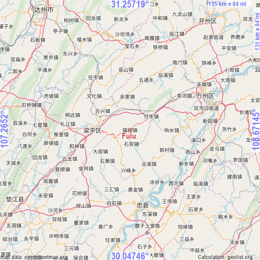
Fulu GPS coordinates[2]
30° 39' 15.192" North, 107° 58' 5.952" East
| Map corner | latitude | longitude |
|---|---|---|
| Upper-left | 31.25719°, | 107.2652° |
| Center: | 30.65422°, | 107.96832° |
| Lower-right: | 30.04746°, | 108.67145° |
| Map W x H: | 134.5×134.5 km | = 83.6×83.6mi |
| max Lat: | 53.31946° ⇑48.4% North |
| Fulu: | 30.65422° |
| min Lat: | ⇓51.6% South 18.22056° |
| min Long | Fulu | max Long |
| 75.07348° | 107.96832° | 134.28917° |
| W 19.3%⇐ | ⇒80.7% E |
Elevation
Elevation of Fulu is 265 m = 869 ft, and this is 219.8 m = 721 ft below average elevation for this country.
| Max E: |
5622 m = 18445 ft | 39.6% |
| Avg. | 484.8 m = 1591 ft | |
| Fulu | 265 m = 869 ft | |
Min E: |
-3 m = -10 ft | 60.4% |
See also: China elevation on elevation.city.
Geographical zone
Fulu is located in North temperate zone (between Tropic of Cancer and the Arctic Circle). Distance of this Northern Tropic circle is 802.5 km =498.7 mi to South.| Distance of | km | miles | from Fulu |
|---|---|---|---|
| North Pole | 6598.6 | 4100.2 | to North |
| Arctic Circle | 3992.7 | 2480.9 | to North |
| Tropic Cancer | 802.5 | 498.7 | to South |
| Equator | 3408.4 | 2117.9 | to South |


Nearby cities:
15 places around Fulu: (largest is in red/bold)
• Baijia
9.2 km =5.7 mi,  222°
222°
• Chengbei
19.1 km =11.9 mi,  292°
292°
• Chengdong
10.4 km =6.5 mi,  315°
315°
• Daguan
19.1 km =11.9 mi,  234°
234°
• Fenshui
13.2 km =8.2 mi,  56°
56°
• Hexing
17.4 km =10.8 mi,  305°
305°
• Houshan
19.9 km =12.4 mi,  16°
16°
• Jinsheng
14.5 km =9 mi,  172°
172°
• Panlong
11.5 km =7.1 mi,  259°
259°
• Qushui
5.9 km =3.7 mi, 57°
• Shi’an
7.2 km =4.5 mi, 173°
• Sunjia
9.5 km =5.9 mi,  27°
27°
• Xiaping
15.6 km =9.7 mi,  327°
327°
• Yujia
17.5 km =10.9 mi,  355°
355°
• Zizhao
13.8 km =8.6 mi,  192°
192°
Sources, notices
• [Note1] Compared only with cities in China existing in our database
• [Src1] Map data: © OpenStreetMap contributors (CC-BY-SA)
• [Src2] Other city data from geonames.org with taken over terms of usage.
• [Src3] Geographical zone / Annual Mean Temperature by Robert A. Rohde @ Wikipedia
