Wangong geodata
Wangong (Inner Mongolia) is a seat of a fourth-order administrative division; located in China in Asia/Shanghai (GMT+8) time zone. In our database, there are 1268 cities with bigger population. Compared to other cities in China, 99.2% of cities are located further ↓South; 75.5% of cities are located further ←West and 77.9% of cities have lower elevation than Wangong. Note1


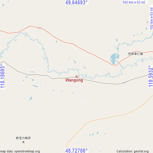
Wangong GPS coordinates[2]
49° 11' 22.308" North, 118° 53' 24.252" East
| Map corner | latitude | longitude |
|---|---|---|
| Upper-left | 49.64693°, | 118.18695° |
| Center: | 49.18953°, | 118.89007° |
| Lower-right: | 48.72786°, | 119.5932° |
| Map W x H: | 102.2×102.2 km | = 63.5×63.5mi |
| max Lat: | 53.31946° ⇑0.8% North |
| Wangong: | 49.18953° |
| min Lat: | ⇓99.2% South 18.22056° |
| min Long | Wangong | max Long |
| 75.07348° | 118.89007° | 134.28917° |
| W 75.5%⇐ | ⇒24.5% E |
Elevation
Elevation of Wangong is 611 m = 2005 ft, and this is 126.2 m = 414 ft above average elevation for this country.
| Max E: |
5622 m = 18445 ft | 22.1% |
| Wangong | 611 m 2005 ft | |
| Avg. | 484.8 m = 1591 ft | |
Min E: |
-3 m = -10 ft | 77.9% |
See also: China elevation on elevation.city.
Geographical zone
Wangong is located in North temperate zone (between Tropic of Cancer and the Arctic Circle). Distance of this North polar circle is 1931.8 km =1200.4 mi to North.| Distance of | km | miles | from Wangong |
|---|---|---|---|
| North Pole | 4537.7 | 2819.6 | to North |
| Arctic Circle | 1931.8 | 1200.4 | to North |
| Tropic Cancer | 2863.4 | 1779.2 | to South |
| Equator | 5469.4 | 3398.5 | to South |


Nearby cities:
15 places around Wangong: (largest is in red/bold)
• Baorixile
67.2 km =41.8 mi,  74°
74°
• Bayan Hure
57 km =35.4 mi,  52°
52°
• Bayan Tuohai
61.6 km =38.3 mi,  95°
95°
• Bayin Tala Dahan’er Minzu
63.9 km =39.7 mi,  107°
107°
• Cuogang
57.7 km =35.9 mi,  277°
277°
• Fendou
63.9 km =39.7 mi,  89°
89°
• Hailar
58.9 km =36.6 mi, 88°
• Hake
85.7 km =53.3 mi, 90°
• Jalai Nur
91 km =56.5 mi,  288°
288°
• Jianshe
64.6 km =40.1 mi,  83°
83°
• Jibu Hulangtu
85.9 km =53.4 mi,  253°
253°
• Xie’ertala
75 km =46.6 mi, 80°
• Xinbaoli Gedong
52.5 km =32.6 mi,  188°
188°
• Xinbaoli Gexi
99.4 km =61.8 mi, 194°
• Yiminhe
93.1 km =57.8 mi,  136°
136°
Sources, notices
• [Note1] Compared only with cities in China existing in our database
• [Src1] Map data: © OpenStreetMap contributors (CC-BY-SA)
• [Src2] Other city data from geonames.org with taken over terms of usage.
• [Src3] Geographical zone / Annual Mean Temperature by Robert A. Rohde @ Wikipedia
