Hexi geodata
Hexi (Qinghai) is a seat of a fourth-order administrative division; located in China in Asia/Shanghai (GMT+8) time zone. In our database, there are 1268 cities with bigger population. Compared to other cities in China, 77.3% of cities are located further ↓South; 93.5% of cities are located further →East and 95.3% of cities have lower elevation than Hexi. Note1


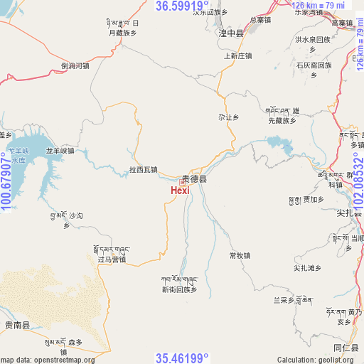
Hexi GPS coordinates[2]
36° 1' 57.504" North, 101° 22' 55.884" East
| Map corner | latitude | longitude |
|---|---|---|
| Upper-left | 36.59919°, | 100.67907° |
| Center: | 36.03264°, | 101.38219° |
| Lower-right: | 35.46199°, | 102.08532° |
| Map W x H: | 126.4×126.4 km | = 78.5×78.5mi |
| max Lat: | 53.31946° ⇑22.7% North |
| Hexi: | 36.03264° |
| min Lat: | ⇓77.3% South 18.22056° |
| min Long | Hexi | max Long |
| 75.07348° | 101.38219° | 134.28917° |
| W 6.5%⇐ | ⇒93.5% E |
Elevation
Elevation of Hexi is 2229 m = 7313 ft, and this is 1744.2 m = 5722 ft above average elevation for this country.
| Max E: |
5622 m = 18445 ft | 4.7% |
| Hexi | 2229 m 7313 ft | |
| Avg. | 484.8 m = 1591 ft | |
Min E: |
-3 m = -10 ft | 95.3% |
See also: China elevation on elevation.city.
Geographical zone
Hexi is located in North temperate zone (between Tropic of Cancer and the Arctic Circle). Distance of this Northern Tropic circle is 1400.5 km =870.2 mi to South.| Distance of | km | miles | from Hexi |
|---|---|---|---|
| North Pole | 6000.6 | 3728.6 | to North |
| Arctic Circle | 3394.7 | 2109.4 | to North |
| Tropic Cancer | 1400.5 | 870.2 | to South |
| Equator | 4006.5 | 2489.5 | to South |


Nearby cities:
15 places around Hexi: (largest is in red/bold)
• Changmu
32.3 km =20.1 mi,  141°
141°
• Cuozhou
48.4 km =30.1 mi,  100°
100°
• Donggou
18.3 km =11.4 mi, 141°
• Garang
27 km =16.8 mi,  36°
36°
• Guomaying
34.7 km =21.6 mi,  224°
224°
• Hedong
7.1 km =4.4 mi,  78°
78°
• Heyin
4.4 km =2.7 mi,  73°
73°
• Jiajia
43.6 km =27.1 mi, 97°
• Kanbula
42.9 km =26.7 mi, 77°
• Kangyang
48 km =29.8 mi,  86°
86°
• Lhakangtang
18.9 km =11.7 mi,  299°
299°
• Longyangxia
45 km =28 mi,  283°
283°
• Shagou
42.1 km =26.2 mi,  252°
252°
• Shangxinzhuang
45.4 km =28.2 mi,  21°
21°
• Xinjie
35.1 km =21.8 mi,  181°
181°
Sources, notices
• [Note1] Compared only with cities in China existing in our database
• [Src1] Map data: © OpenStreetMap contributors (CC-BY-SA)
• [Src2] Other city data from geonames.org with taken over terms of usage.
• [Src3] Geographical zone / Annual Mean Temperature by Robert A. Rohde @ Wikipedia
