Zhonghouhe geodata
Zhonghouhe (Inner Mongolia) is a seat of a fourth-order administrative division; located in China in Asia/Shanghai (GMT+8) time zone. In our database, there are 1268 cities with bigger population. Compared to other cities in China, 89.5% of cities are located further ↓South; 66.8% of cities are located further →East and 92.9% of cities have lower elevation than Zhonghouhe. Note1


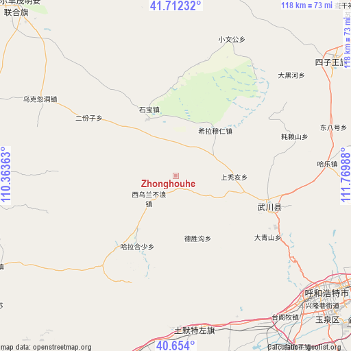
Zhonghouhe GPS coordinates[2]
41° 11' 7.08" North, 111° 4' 0.3" East
| Map corner | latitude | longitude |
|---|---|---|
| Upper-left | 41.71232°, | 110.36363° |
| Center: | 41.1853°, | 111.06675° |
| Lower-right: | 40.654°, | 111.76988° |
| Map W x H: | 117.7×117.7 km | = 73.1×73.1mi |
| max Lat: | 53.31946° ⇑10.5% North |
| Zhonghouhe: | 41.1853° |
| min Lat: | ⇓89.5% South 18.22056° |
| min Long | Zhonghouhe | max Long |
| 75.07348° | 111.06675° | 134.28917° |
| W 33.2%⇐ | ⇒66.8% E |
Elevation
Elevation of Zhonghouhe is 1691 m = 5548 ft, and this is 1206.2 m = 3957 ft above average elevation for this country.
| Max E: |
5622 m = 18445 ft | 7.1% |
| Zhonghouhe | 1691 m 5548 ft | |
| Avg. | 484.8 m = 1591 ft | |
Min E: |
-3 m = -10 ft | 92.9% |
See also: China elevation on elevation.city.
Geographical zone
Zhonghouhe is located in North temperate zone (between Tropic of Cancer and the Arctic Circle). Distance of this Northern Tropic circle is 1973.5 km =1226.3 mi to South.| Distance of | km | miles | from Zhonghouhe |
|---|---|---|---|
| North Pole | 5427.7 | 3372.6 | to North |
| Arctic Circle | 2821.8 | 1753.4 | to North |
| Tropic Cancer | 1973.5 | 1226.3 | to South |
| Equator | 4579.4 | 2845.5 | to South |


Nearby cities:
15 places around Zhonghouhe: (largest is in red/bold)
• Anzihao
31.7 km =19.7 mi,  103°
103°
• Changhan Mutai
24.2 km =15 mi,  69°
69°
• Daqingshan
37.7 km =23.4 mi,  123°
123°
• Donghongsheng
22.4 km =13.9 mi,  316°
316°
• Dongtucheng
17.9 km =11.1 mi,  114°
114°
• Erfenzi
34.7 km =21.6 mi,  305°
305°
• Halamendu
36.6 km =22.7 mi,  232°
232°
• Har Huxu
26.6 km =16.5 mi,  207°
207°
• Hoh Ereg
32.9 km =20.4 mi, 107°
• Miaogou
39.2 km =24.4 mi, 207°
• Moguyao
24.4 km =15.2 mi,  148°
148°
• Nalinggou
22.2 km =13.8 mi,  159°
159°
• Shangtuhai
20.5 km =12.7 mi,  91°
91°
• Xihong Shanzi
32.3 km =20.1 mi,  271°
271°
• Xiwulan Bulang
11 km =6.8 mi, 227°
Sources, notices
• [Note1] Compared only with cities in China existing in our database
• [Src1] Map data: © OpenStreetMap contributors (CC-BY-SA)
• [Src2] Other city data from geonames.org with taken over terms of usage.
• [Src3] Geographical zone / Annual Mean Temperature by Robert A. Rohde @ Wikipedia
