Har Huxu geodata
Har Huxu (Inner Mongolia) is a seat of a fourth-order administrative division; located in China in Asia/Shanghai (GMT+8) time zone. In our database, there are 1268 cities with bigger population. Compared to other cities in China, 89.1% of cities are located further ↓South; 67.3% of cities are located further →East and 92.4% of cities have lower elevation than Har Huxu. Note1


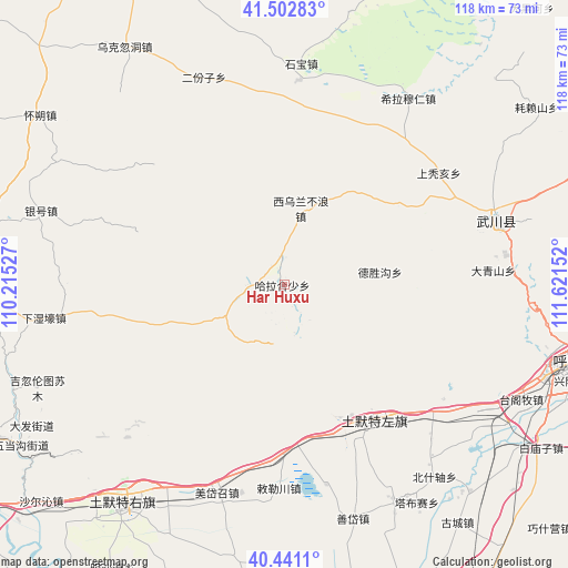
Har Huxu GPS coordinates[2]
40° 58' 26.76" North, 110° 55' 6.204" East
| Map corner | latitude | longitude |
|---|---|---|
| Upper-left | 41.50283°, | 110.21527° |
| Center: | 40.9741°, | 110.91839° |
| Lower-right: | 40.4411°, | 111.62152° |
| Map W x H: | 118.1×118.1 km | = 73.4×73.4mi |
| max Lat: | 53.31946° ⇑10.9% North |
| Har Huxu: | 40.9741° |
| min Lat: | ⇓89.1% South 18.22056° |
| min Long | Har Huxu | max Long |
| 75.07348° | 110.91839° | 134.28917° |
| W 32.7%⇐ | ⇒67.3% E |
Elevation
Elevation of Har Huxu is 1628 m = 5341 ft, and this is 1143.2 m = 3751 ft above average elevation for this country.
| Max E: |
5622 m = 18445 ft | 7.6% |
| Har Huxu | 1628 m 5341 ft | |
| Avg. | 484.8 m = 1591 ft | |
Min E: |
-3 m = -10 ft | 92.4% |
See also: China elevation on elevation.city.
Geographical zone
Har Huxu is located in North temperate zone (between Tropic of Cancer and the Arctic Circle). Distance of this Northern Tropic circle is 1950 km =1211.7 mi to South.| Distance of | km | miles | from Har Huxu |
|---|---|---|---|
| North Pole | 5451.2 | 3387.2 | to North |
| Arctic Circle | 2845.3 | 1768 | to North |
| Tropic Cancer | 1950 | 1211.7 | to South |
| Equator | 4555.9 | 2830.9 | to South |


Nearby cities:
15 places around Har Huxu: (largest is in red/bold)
• Damiao
37 km =23 mi,  290°
290°
• Daqingshan
44.2 km =27.5 mi,  86°
86°
• Donghongsheng
39.9 km =24.8 mi,  355°
355°
• Dongtucheng
32.9 km =20.4 mi,  60°
60°
• Halamendu
16.6 km =10.3 mi,  273°
273°
• Miaogou
12.7 km =7.9 mi,  205°
205°
• Moguyao
25.3 km =15.7 mi,  84°
84°
• Nalinggou
20.6 km =12.8 mi, 82°
• Qasq
34.1 km =21.2 mi,  148°
148°
• Shangtuhai
40.2 km =25 mi,  54°
54°
• Xiashihao
27.8 km =17.3 mi,  252°
252°
• Xihong Shanzi
31.6 km =19.6 mi,  321°
321°
• Xinjiang
45.4 km =28.2 mi,  262°
262°
• Xiwulan Bulang
16.6 km =10.3 mi,  14°
14°
• Zhonghouhe
26.6 km =16.5 mi,  27°
27°
Sources, notices
• [Note1] Compared only with cities in China existing in our database
• [Src1] Map data: © OpenStreetMap contributors (CC-BY-SA)
• [Src2] Other city data from geonames.org with taken over terms of usage.
• [Src3] Geographical zone / Annual Mean Temperature by Robert A. Rohde @ Wikipedia
