Wenshan City geodata
Wenshan City (Yunnan) is a seat of a second-order administrative division; located in China in Asia/Shanghai (GMT+8) time zone. With population of 450,000 people, there are 142 cities with bigger population in this country. Compared to other cities in China, 92.8% of cities are located further ↑North; 90% of cities are located further →East and 88.9% of cities have lower elevation than Wenshan City. Note1


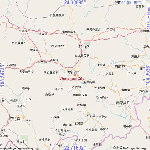
Wenshan City GPS coordinates[2]
23° 21' 47.016" North, 104° 15' 1.692" East
| Map corner | latitude | longitude |
|---|---|---|
| Upper-left | 24.00695°, | 103.54735° |
| Center: | 23.36306°, | 104.25047° |
| Lower-right: | 22.71602°, | 104.9536° |
| Map W x H: | 143.5×143.5 km | = 89.2×89.2mi |
| max Lat: | 53.31946° ⇑92.8% North |
| Wenshan City: | 23.36306° |
| min Lat: | ⇓7.2% South 18.22056° |
| min Long | Wenshan City | max Long |
| 75.07348° | 104.25047° | 134.28917° |
| W 10%⇐ | ⇒90% E |
Elevation
Elevation of Wenshan City is 1257 m = 4124 ft, and this is 772.2 m = 2533 ft above average elevation for this country.
| Max E: |
5622 m = 18445 ft | 11.1% |
| Wenshan City | 1257 m 4124 ft | |
| Avg. | 484.8 m = 1591 ft | |
Min E: |
-3 m = -10 ft | 88.9% |
See also: Wenshan City elevation on elevation.city.
Geographical zone
Wenshan City is located in North Torrid zone (between Equator and Tropic of Cancer). Distance of this Northern Tropic circle is 8.2 km =5.1 mi to North.| Distance of | km | miles | from Wenshan City |
|---|---|---|---|
| North Pole | 7409.3 | 4603.9 | to North |
| Arctic Circle | 4803.4 | 2984.7 | to North |
| Tropic Cancer | 8.2 | 5.1 | to North |
| Equator | 2597.7 | 1614.1 | to South |


Nearby cities:
15 places around Wenshan City: (largest is in red/bold)
• Daxinshao
127 km =78.9 mi,  320°
320°
• Gejiu
111.9 km =69.5 mi,  269°
269°
• Hekou
94.9 km =59 mi,  194°
194°
• Jiangna
30.1 km =18.7 mi,  24°
24°
• Jinhe
122 km =75.8 mi,  237°
237°
• Jinping
74.3 km =46.2 mi,  358°
358°
• Kaihua
2.8 km =1.7 mi,  75°
75°
• Kaiyuan
103.4 km =64.2 mi,  291°
291°
• Liancheng
113.6 km =70.6 mi,  47°
47°
• Mabai
44 km =27.3 mi,  152°
152°
• Mali
56.6 km =35.2 mi,  117°
117°
• Wenlan
83.1 km =51.6 mi, 269°
• Xisa
47.7 km =29.6 mi, 78°
• Yuping
69.9 km =43.4 mi,  232°
232°
• Zhuyuan
118.4 km =73.6 mi,  314°
314°
Sources, notices
• [Note1] Compared only with cities in China existing in our database
• [Src1] Map data: © OpenStreetMap contributors (CC-BY-SA)
• [Src2] Other city data from geonames.org with taken over terms of usage.
• [Src3] Geographical zone / Annual Mean Temperature by Robert A. Rohde @ Wikipedia
