Wenlan geodata
Wenlan (Yunnan) is a seat of a third-order administrative division; located in China in Asia/Shanghai (GMT+8) time zone. In our database, there are 1268 cities with bigger population. Compared to other cities in China, 92.8% of cities are located further ↑North; 91% of cities are located further →East and 89.4% of cities have lower elevation than Wenlan. Note1


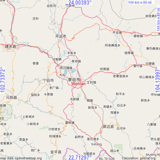
Wenlan GPS coordinates[2]
23° 21' 36.072" North, 103° 26' 12.624" East
| Map corner | latitude | longitude |
|---|---|---|
| Upper-left | 24.00393°, | 102.73372° |
| Center: | 23.36002°, | 103.43684° |
| Lower-right: | 22.71297°, | 104.13997° |
| Map W x H: | 143.5×143.5 km | = 89.2×89.2mi |
| max Lat: | 53.31946° ⇑92.8% North |
| Wenlan: | 23.36002° |
| min Lat: | ⇓7.2% South 18.22056° |
| min Long | Wenlan | max Long |
| 75.07348° | 103.43684° | 134.28917° |
| W 9%⇐ | ⇒91% E |
Elevation
Elevation of Wenlan is 1309 m = 4295 ft, and this is 824.2 m = 2704 ft above average elevation for this country.
| Max E: |
5622 m = 18445 ft | 10.6% |
| Wenlan | 1309 m 4295 ft | |
| Avg. | 484.8 m = 1591 ft | |
Min E: |
-3 m = -10 ft | 89.4% |
See also: China elevation on elevation.city.
Geographical zone
Wenlan is located in North Torrid zone (between Equator and Tropic of Cancer). Distance of this Northern Tropic circle is 8.5 km =5.3 mi to North.| Distance of | km | miles | from Wenlan |
|---|---|---|---|
| North Pole | 7409.7 | 4604.2 | to North |
| Arctic Circle | 4803.8 | 2984.9 | to North |
| Tropic Cancer | 8.5 | 5.3 | to North |
| Equator | 2597.4 | 1613.9 | to South |


Nearby cities:
15 places around Wenlan: (largest is in red/bold)
• Daxinshao
97.9 km =60.8 mi,  0°
0°
• Gejiu
28.9 km =18 mi,  270°
270°
• Hongxi
88.1 km =54.7 mi,  352°
352°
• Huaxijie
90.4 km =56.2 mi,  331°
331°
• Jiangna
99.4 km =61.8 mi,  73°
73°
• Jinhe
68.7 km =42.7 mi,  196°
196°
• Kaihua
85.8 km =53.3 mi,  89°
89°
• Kaiyuan
39.9 km =24.8 mi,  340°
340°
• Lin’an
67.4 km =41.9 mi,  293°
293°
• Nansha
64.8 km =40.3 mi,  252°
252°
• Panjiang
79.9 km =49.6 mi, 336°
• Sijia
92.8 km =57.7 mi, 344°
• Wenshan City
83.1 km =51.6 mi, 89°
• Yuping
51 km =31.7 mi,  146°
146°
• Zhuyuan
83.2 km =51.7 mi,  358°
358°
Sources, notices
• [Note1] Compared only with cities in China existing in our database
• [Src1] Map data: © OpenStreetMap contributors (CC-BY-SA)
• [Src2] Other city data from geonames.org with taken over terms of usage.
• [Src3] Geographical zone / Annual Mean Temperature by Robert A. Rohde @ Wikipedia
