Shuangyushu geodata
Shuangyushu (Heilongjiang) is a seat of a fourth-order administrative division; located in China in Asia/Shanghai (GMT+8) time zone. In our database, there are 1268 cities with bigger population. Compared to other cities in China, 95.2% of cities are located further ↓South; 94.4% of cities are located further ←West and 51.6% of cities have higher elevation than Shuangyushu. Note1


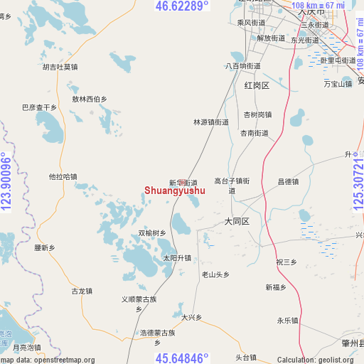
Shuangyushu GPS coordinates[2]
46° 8' 16.188" North, 124° 36' 14.688" East
| Map corner | latitude | longitude |
|---|---|---|
| Upper-left | 46.62289°, | 123.90096° |
| Center: | 46.13783°, | 124.60408° |
| Lower-right: | 45.64846°, | 125.30721° |
| Map W x H: | 108.3×108.3 km | = 67.3×67.3mi |
| max Lat: | 53.31946° ⇑4.8% North |
| Shuangyushu: | 46.13783° |
| min Lat: | ⇓95.2% South 18.22056° |
| min Long | Shuangyushu | max Long |
| 75.07348° | 124.60408° | 134.28917° |
| W 94.4%⇐ | ⇒5.6% E |
Elevation
Elevation of Shuangyushu is 152 m = 499 ft, and this is 332.8 m = 1092 ft below average elevation for this country.
| Max E: |
5622 m = 18445 ft | 51.6% |
| Avg. | 484.8 m = 1591 ft | |
| Shuangyushu | 152 m = 499 ft | |
Min E: |
-3 m = -10 ft | 48.4% |
See also: China elevation on elevation.city.
Geographical zone
Shuangyushu is located in North temperate zone (between Tropic of Cancer and the Arctic Circle). Distance of this North polar circle is 2271.1 km =1411.2 mi to North.| Distance of | km | miles | from Shuangyushu |
|---|---|---|---|
| North Pole | 4877 | 3030.4 | to North |
| Arctic Circle | 2271.1 | 1411.2 | to North |
| Tropic Cancer | 2524.1 | 1568.4 | to South |
| Equator | 5130 | 3187.6 | to South |


Nearby cities:
15 places around Shuangyushu: (largest is in red/bold)
• Bajingzi
16.1 km =10 mi,  143°
143°
• Bayan Qagan
48.4 km =30.1 mi,  297°
297°
• Changde
31.7 km =19.7 mi,  89°
89°
• Daqing
58.1 km =36.1 mi,  31°
31°
• Datong
19.7 km =12.2 mi,  125°
125°
• Gaotaizi
14.7 km =9.1 mi, 92°
• Honggang
36.3 km =22.6 mi,  36°
36°
• Hujil Tohom
49.9 km =31 mi,  313°
313°
• Linyuan
20.5 km =12.7 mi,  22°
22°
• Oroin Xibe
34 km =21.1 mi, 307°
• Shengping
51.7 km =32.1 mi,  80°
80°
• Talin Hiag
35.7 km =22.2 mi,  273°
273°
• Wanbaoshan
54.1 km =33.6 mi,  58°
58°
• Xinglongquan
9 km =5.6 mi,  5°
5°
• Xingshugang
30 km =18.6 mi,  47°
47°
Sources, notices
• [Note1] Compared only with cities in China existing in our database
• [Src1] Map data: © OpenStreetMap contributors (CC-BY-SA)
• [Src2] Other city data from geonames.org with taken over terms of usage.
• [Src3] Geographical zone / Annual Mean Temperature by Robert A. Rohde @ Wikipedia
