Fanrong geodata
Fanrong (Heilongjiang) is a seat of a fourth-order administrative division; located in China in Asia/Shanghai (GMT+8) time zone. In our database, there are 1268 cities with bigger population. Compared to other cities in China, 97.6% of cities are located further ↓South; 95.8% of cities are located further ←West and 56.4% of cities have lower elevation than Fanrong. Note1


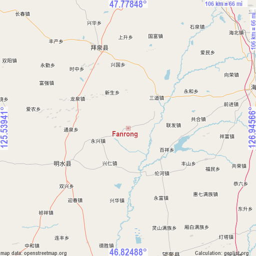
Fanrong GPS coordinates[2]
47° 18' 13.788" North, 126° 14' 33.108" East
| Map corner | latitude | longitude |
|---|---|---|
| Upper-left | 47.77848°, | 125.53941° |
| Center: | 47.30383°, | 126.24253° |
| Lower-right: | 46.82488°, | 126.94566° |
| Map W x H: | 106×106 km | = 65.9×65.9mi |
| max Lat: | 53.31946° ⇑2.4% North |
| Fanrong: | 47.30383° |
| min Lat: | ⇓97.6% South 18.22056° |
| min Long | Fanrong | max Long |
| 75.07348° | 126.24253° | 134.28917° |
| W 95.8%⇐ | ⇒4.2% E |
Elevation
Elevation of Fanrong is 220 m = 722 ft, and this is 264.8 m = 869 ft below average elevation for this country.
| Max E: |
5622 m = 18445 ft | 43.6% |
| Avg. | 484.8 m = 1591 ft | |
| Fanrong | 220 m = 722 ft | |
Min E: |
-3 m = -10 ft | 56.4% |
See also: China elevation on elevation.city.
Geographical zone
Fanrong is located in North temperate zone (between Tropic of Cancer and the Arctic Circle). Distance of this North polar circle is 2141.5 km =1330.7 mi to North.| Distance of | km | miles | from Fanrong |
|---|---|---|---|
| North Pole | 4747.4 | 2949.9 | to North |
| Arctic Circle | 2141.5 | 1330.7 | to North |
| Tropic Cancer | 2653.8 | 1649 | to South |
| Equator | 5259.7 | 3268.2 | to South |


Nearby cities:
15 places around Fanrong: (largest is in red/bold)
• Baixiang
18.2 km =11.3 mi,  119°
119°
• Guangrong
5.9 km =3.7 mi,  75°
75°
• Huaguang
27.8 km =17.3 mi,  28°
28°
• Lianfa
18.7 km =11.6 mi,  85°
85°
• Longquan
24.5 km =15.2 mi,  300°
300°
• Lunhe
23.2 km =14.4 mi,  142°
142°
• Sandao
17.3 km =10.7 mi,  43°
43°
• Shuren
16 km =9.9 mi,  185°
185°
• Tongquan
23.6 km =14.7 mi,  269°
269°
• Xingguo
26.7 km =16.6 mi,  350°
350°
• Xingquan
22.6 km =14 mi,  289°
289°
• Xingren
16.2 km =10.1 mi,  207°
207°
• Xinsheng
16.3 km =10.1 mi,  336°
336°
• Yongjiu
26.3 km =16.3 mi,  221°
221°
• Yongxing
13.4 km =8.3 mi,  248°
248°
Sources, notices
• [Note1] Compared only with cities in China existing in our database
• [Src1] Map data: © OpenStreetMap contributors (CC-BY-SA)
• [Src2] Other city data from geonames.org with taken over terms of usage.
• [Src3] Geographical zone / Annual Mean Temperature by Robert A. Rohde @ Wikipedia
