Xingren geodata
Xingren (Heilongjiang) is a seat of a fourth-order administrative division; located in China in Asia/Shanghai (GMT+8) time zone. In our database, there are 1268 cities with bigger population. Compared to other cities in China, 97.3% of cities are located further ↓South; 95.7% of cities are located further ←West and 57.5% of cities have lower elevation than Xingren. Note1


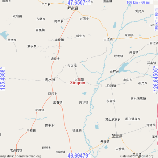
Xingren GPS coordinates[2]
47° 10' 29.64" North, 126° 8' 30.912" East
| Map corner | latitude | longitude |
|---|---|---|
| Upper-left | 47.65071°, | 125.4388° |
| Center: | 47.1749°, | 126.14192° |
| Lower-right: | 46.69479°, | 126.84505° |
| Map W x H: | 106.3×106.3 km | = 66.1×66.1mi |
| max Lat: | 53.31946° ⇑2.7% North |
| Xingren: | 47.1749° |
| min Lat: | ⇓97.3% South 18.22056° |
| min Long | Xingren | max Long |
| 75.07348° | 126.14192° | 134.28917° |
| W 95.7%⇐ | ⇒4.3% E |
Elevation
Elevation of Xingren is 230 m = 755 ft, and this is 254.8 m = 836 ft below average elevation for this country.
| Max E: |
5622 m = 18445 ft | 42.5% |
| Avg. | 484.8 m = 1591 ft | |
| Xingren | 230 m = 755 ft | |
Min E: |
-3 m = -10 ft | 57.5% |
See also: China elevation on elevation.city.
Geographical zone
Xingren is located in North temperate zone (between Tropic of Cancer and the Arctic Circle). Distance of this North polar circle is 2155.8 km =1339.6 mi to North.| Distance of | km | miles | from Xingren |
|---|---|---|---|
| North Pole | 4761.7 | 2958.8 | to North |
| Arctic Circle | 2155.8 | 1339.6 | to North |
| Tropic Cancer | 2639.4 | 1640 | to South |
| Equator | 5245.4 | 3259.3 | to South |


Nearby cities:
15 places around Xingren: (largest is in red/bold)
• Baixiang
24.1 km =15 mi,  77°
77°
• Fanrong
16.2 km =10.1 mi,  27°
27°
• Guangrong
20.7 km =12.9 mi,  40°
40°
• Lunhe
22.1 km =13.7 mi,  100°
100°
• Mingshui
18.3 km =11.4 mi,  272°
272°
• Shuangxing
20.1 km =12.5 mi,  242°
242°
• Shuren
6.1 km =3.8 mi, 104°
• Tongquan
21.3 km =13.2 mi,  311°
311°
• Xinghua
15.6 km =9.7 mi,  169°
169°
• Xingquan
25.8 km =16 mi,  327°
327°
• Xinsheng
29.3 km =18.2 mi,  2°
2°
• Yingchun
21.3 km =13.2 mi,  223°
223°
• Yongfu
25.7 km =16 mi,  123°
123°
• Yongjiu
11.3 km =7 mi, 242°
• Yongxing
10.5 km =6.5 mi, 332°
Sources, notices
• [Note1] Compared only with cities in China existing in our database
• [Src1] Map data: © OpenStreetMap contributors (CC-BY-SA)
• [Src2] Other city data from geonames.org with taken over terms of usage.
• [Src3] Geographical zone / Annual Mean Temperature by Robert A. Rohde @ Wikipedia
