Xingfu geodata
Xingfu (Heilongjiang) is a seat of a fourth-order administrative division; located in China in Asia/Shanghai (GMT+8) time zone. In our database, there are 1268 cities with bigger population. Compared to other cities in China, 96.2% of cities are located further ↓South; 96.9% of cities are located further ←West and 52.3% of cities have lower elevation than Xingfu. Note1


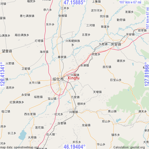
Xingfu GPS coordinates[2]
46° 40' 42.96" North, 127° 6' 59.508" East
| Map corner | latitude | longitude |
|---|---|---|
| Upper-left | 47.15885°, | 126.41341° |
| Center: | 46.6786°, | 127.11653° |
| Lower-right: | 46.19404°, | 127.81966° |
| Map W x H: | 107.3×107.3 km | = 66.7×66.7mi |
| max Lat: | 53.31946° ⇑3.8% North |
| Xingfu: | 46.6786° |
| min Lat: | ⇓96.2% South 18.22056° |
| min Long | Xingfu | max Long |
| 75.07348° | 127.11653° | 134.28917° |
| W 96.9%⇐ | ⇒3.1% E |
Elevation
Elevation of Xingfu is 183 m = 600 ft, and this is 301.8 m = 990 ft below average elevation for this country.
| Max E: |
5622 m = 18445 ft | 47.7% |
| Avg. | 484.8 m = 1591 ft | |
| Xingfu | 183 m = 600 ft | |
Min E: |
-3 m = -10 ft | 52.3% |
See also: China elevation on elevation.city.
Geographical zone
Xingfu is located in North temperate zone (between Tropic of Cancer and the Arctic Circle). Distance of this North polar circle is 2211 km =1373.9 mi to North.| Distance of | km | miles | from Xingfu |
|---|---|---|---|
| North Pole | 4816.9 | 2993.1 | to North |
| Arctic Circle | 2211 | 1373.9 | to North |
| Tropic Cancer | 2584.3 | 1605.8 | to South |
| Equator | 5190.2 | 3225 | to South |


Nearby cities:
15 places around Xingfu: (largest is in red/bold)
• Baoshan
23.4 km =14.5 mi,  223°
223°
• Dayou
10.9 km =6.8 mi,  244°
244°
• Dexiang
21.5 km =13.4 mi,  166°
166°
• Dongfu
8.2 km =5.1 mi,  257°
257°
• Dongjin
9.8 km =6.1 mi,  46°
46°
• Huansheng
21.5 km =13.4 mi, 46°
• Jinhe
6.9 km =4.3 mi,  23°
23°
• Longtai
8 km =5 mi,  83°
83°
• Minle
23.9 km =14.9 mi, 76°
• Qinjia
15.8 km =9.8 mi,  325°
325°
• Shuanghe
23 km =14.3 mi,  9°
9°
• Suihua
10.2 km =6.3 mi, 244°
• Wanfa
16 km =9.9 mi,  178°
178°
• Xinghe
23 km =14.3 mi,  356°
356°
• Xinhua
21.4 km =13.3 mi, 259°
Sources, notices
• [Note1] Compared only with cities in China existing in our database
• [Src1] Map data: © OpenStreetMap contributors (CC-BY-SA)
• [Src2] Other city data from geonames.org with taken over terms of usage.
• [Src3] Geographical zone / Annual Mean Temperature by Robert A. Rohde @ Wikipedia
