Dayou geodata
Dayou (Heilongjiang) is a seat of a third-order administrative division; located in China in Asia/Shanghai (GMT+8) time zone. In our database, there are 1268 cities with bigger population. Compared to other cities in China, 96.1% of cities are located further ↓South; 96.7% of cities are located further ←West and 52% of cities have lower elevation than Dayou. Note1


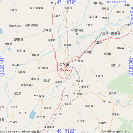
Dayou GPS coordinates[2]
46° 38' 10.176" North, 126° 59' 15.108" East
| Map corner | latitude | longitude |
|---|---|---|
| Upper-left | 47.11679°, | 126.28441° |
| Center: | 46.63616°, | 126.98753° |
| Lower-right: | 46.15122°, | 127.69066° |
| Map W x H: | 107.4×107.4 km | = 66.7×66.7mi |
| max Lat: | 53.31946° ⇑3.9% North |
| Dayou: | 46.63616° |
| min Lat: | ⇓96.1% South 18.22056° |
| min Long | Dayou | max Long |
| 75.07348° | 126.98753° | 134.28917° |
| W 96.7%⇐ | ⇒3.3% E |
Elevation
Elevation of Dayou is 181 m = 594 ft, and this is 303.8 m = 997 ft below average elevation for this country.
| Max E: |
5622 m = 18445 ft | 48% |
| Avg. | 484.8 m = 1591 ft | |
| Dayou | 181 m = 594 ft | |
Min E: |
-3 m = -10 ft | 52% |
See also: China elevation on elevation.city.
Geographical zone
Dayou is located in North temperate zone (between Tropic of Cancer and the Arctic Circle). Distance of this North polar circle is 2215.7 km =1376.8 mi to North.| Distance of | km | miles | from Dayou |
|---|---|---|---|
| North Pole | 4821.6 | 2996 | to North |
| Arctic Circle | 2215.7 | 1376.8 | to North |
| Tropic Cancer | 2579.5 | 1602.8 | to South |
| Equator | 5185.5 | 3222.1 | to South |


Nearby cities:
15 places around Dayou: (largest is in red/bold)
• Baoshan
13.8 km =8.6 mi,  207°
207°
• Dexiang
22 km =13.7 mi,  136°
136°
• Dongfu
3.4 km =2.1 mi,  32°
32°
• Dongjin
20.4 km =12.7 mi,  55°
55°
• Hongguang
23.7 km =14.7 mi,  183°
183°
• Jinhe
16.7 km =10.4 mi,  48°
48°
• Longtai
18.6 km =11.6 mi,  72°
72°
• Qinjia
17.8 km =11.1 mi,  2°
2°
• Suihua
0.7 km =0.4 mi, 56°
• Suisheng
19.6 km =12.2 mi,  235°
235°
• Taipingchuan
19.1 km =11.9 mi,  266°
266°
• Wanfa
15.2 km =9.4 mi, 138°
• Xingfu
10.9 km =6.8 mi, 64°
• Xinglong
23.4 km =14.5 mi,  158°
158°
• Xinhua
11.2 km =7 mi, 274°
Sources, notices
• [Note1] Compared only with cities in China existing in our database
• [Src1] Map data: © OpenStreetMap contributors (CC-BY-SA)
• [Src2] Other city data from geonames.org with taken over terms of usage.
• [Src3] Geographical zone / Annual Mean Temperature by Robert A. Rohde @ Wikipedia
