Henglin geodata
Henglin (Hubei) is a seat of a fourth-order administrative division; located in China in Asia/Shanghai (GMT+8) time zone. In our database, there are 1268 cities with bigger population. Compared to other cities in China, 50.7% of cities are located further ↓South; 56.5% of cities are located further →East and 74.4% of cities have higher elevation than Henglin. Note1


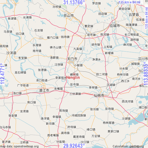
Henglin GPS coordinates[2]
30° 32' 2.148" North, 113° 10' 48.792" East
| Map corner | latitude | longitude |
|---|---|---|
| Upper-left | 31.13766°, | 112.4771° |
| Center: | 30.53393°, | 113.18022° |
| Lower-right: | 29.92643°, | 113.88335° |
| Map W x H: | 134.7×134.7 km | = 83.7×83.7mi |
| max Lat: | 53.31946° ⇑49.3% North |
| Henglin: | 30.53393° |
| min Lat: | ⇓50.7% South 18.22056° |
| min Long | Henglin | max Long |
| 75.07348° | 113.18022° | 134.28917° |
| W 43.5%⇐ | ⇒56.5% E |
Elevation
Elevation of Henglin is 38 m = 125 ft, and this is 446.8 m = 1466 ft below average elevation for this country.
| Max E: |
5622 m = 18445 ft | 74.4% |
| Avg. | 484.8 m = 1591 ft | |
| Henglin | 38 m = 125 ft | |
Min E: |
-3 m = -10 ft | 25.6% |
See also: China elevation on elevation.city.
Geographical zone
Henglin is located in North temperate zone (between Tropic of Cancer and the Arctic Circle). Distance of this Northern Tropic circle is 789.1 km =490.3 mi to South.| Distance of | km | miles | from Henglin |
|---|---|---|---|
| North Pole | 6612 | 4108.5 | to North |
| Arctic Circle | 4006.1 | 2489.3 | to North |
| Tropic Cancer | 789.1 | 490.3 | to South |
| Equator | 3395.1 | 2109.6 | to South |


Nearby cities:
15 places around Henglin: (largest is in red/bold)
• Ganyi
19.2 km =11.9 mi,  86°
86°
• Houkou
10.8 km =6.7 mi,  339°
339°
• Huangtan
16.8 km =10.4 mi,  327°
327°
• Jingling
12.8 km =8 mi,  351°
351°
• Jingling
15 km =9.3 mi, 329°
• Lijiazui
12.3 km =7.6 mi,  256°
256°
• Mawan
14.9 km =9.3 mi,  71°
71°
• Mayang
13.5 km =8.4 mi,  143°
143°
• Pengshi
9 km =5.6 mi,  178°
178°
• Sanfutan
17.6 km =10.9 mi, 175°
• Tianmen
14.1 km =8.8 mi, 349°
• Wangchang
16.7 km =10.4 mi,  303°
303°
• Xiaoban
9.3 km =5.8 mi,  22°
22°
• Yanglin
12 km =7.5 mi,  3°
3°
• Zhengchang
15.3 km =9.5 mi,  252°
252°
Sources, notices
• [Note1] Compared only with cities in China existing in our database
• [Src1] Map data: © OpenStreetMap contributors (CC-BY-SA)
• [Src2] Other city data from geonames.org with taken over terms of usage.
• [Src3] Geographical zone / Annual Mean Temperature by Robert A. Rohde @ Wikipedia
