Langjun geodata
Langjun (Hubei) is a seat of a fourth-order administrative division; located in China in Asia/Shanghai (GMT+8) time zone. In our database, there are 1268 cities with bigger population. Compared to other cities in China, 53.8% of cities are located further ↓South; 53.2% of cities are located further →East and 77.2% of cities have higher elevation than Langjun. Note1


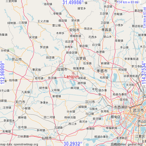
Langjun GPS coordinates[2]
30° 53' 54.348" North, 113° 40' 19.956" East
| Map corner | latitude | longitude |
|---|---|---|
| Upper-left | 31.49986°, | 112.96909° |
| Center: | 30.89843°, | 113.67221° |
| Lower-right: | 30.2932°, | 114.37534° |
| Map W x H: | 134.2×134.2 km | = 83.4×83.4mi |
| max Lat: | 53.31946° ⇑46.2% North |
| Langjun: | 30.89843° |
| min Lat: | ⇓53.8% South 18.22056° |
| min Long | Langjun | max Long |
| 75.07348° | 113.67221° | 134.28917° |
| W 46.8%⇐ | ⇒53.2% E |
Elevation
Elevation of Langjun is 32 m = 105 ft, and this is 452.8 m = 1486 ft below average elevation for this country.
| Max E: |
5622 m = 18445 ft | 77.2% |
| Avg. | 484.8 m = 1591 ft | |
| Langjun | 32 m = 105 ft | |
Min E: |
-3 m = -10 ft | 22.8% |
See also: China elevation on elevation.city.
Geographical zone
Langjun is located in North temperate zone (between Tropic of Cancer and the Arctic Circle). Distance of this Northern Tropic circle is 829.7 km =515.6 mi to South.| Distance of | km | miles | from Langjun |
|---|---|---|---|
| North Pole | 6571.5 | 4083.3 | to North |
| Arctic Circle | 3965.6 | 2464.1 | to North |
| Tropic Cancer | 829.7 | 515.6 | to South |
| Equator | 3435.6 | 2134.8 | to South |


Nearby cities:
15 places around Langjun: (largest is in red/bold)
• Changjiangbu
6.6 km =4.1 mi,  128°
128°
• Chengbei
12.1 km =7.5 mi,  307°
307°
• Chengzhong
12.5 km =7.8 mi,  294°
294°
• Daoqiao
11.7 km =7.3 mi,  138°
138°
• Dongmafang
3.2 km =2 mi,  44°
44°
• Geputan
6.9 km =4.3 mi,  47°
47°
• Huangtan
9.7 km =6 mi,  273°
273°
• Huzhen
9.1 km =5.7 mi,  96°
96°
• Langjun
3.1 km =1.9 mi,  297°
297°
• Mahe
13.2 km =8.2 mi,  173°
173°
• Qingminghe
15.3 km =9.5 mi,  6°
6°
• Shahe
14.9 km =9.3 mi,  74°
74°
• Silipeng
7.8 km =4.8 mi, 311°
• Tian’e
16.4 km =10.2 mi,  212°
212°
• Wuluo
15.9 km =9.9 mi, 53°
Sources, notices
• [Note1] Compared only with cities in China existing in our database
• [Src1] Map data: © OpenStreetMap contributors (CC-BY-SA)
• [Src2] Other city data from geonames.org with taken over terms of usage.
• [Src3] Geographical zone / Annual Mean Temperature by Robert A. Rohde @ Wikipedia
