Wangying geodata
Wangying (Hubei) is a seat of a fourth-order administrative division; located in China in Asia/Shanghai (GMT+8) time zone. In our database, there are 1268 cities with bigger population. Compared to other cities in China, 51.5% of cities are located further ↑North; 77.7% of cities are located further →East and 87.1% of cities have lower elevation than Wangying. Note1


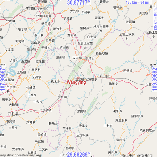
Wangying GPS coordinates[2]
30° 16' 18.516" North, 108° 41' 37.644" East
| Map corner | latitude | longitude |
|---|---|---|
| Upper-left | 30.87717°, | 107.99067° |
| Center: | 30.27181°, | 108.69379° |
| Lower-right: | 29.66269°, | 109.39692° |
| Map W x H: | 135×135 km | = 83.9×83.9mi |
| max Lat: | 53.31946° ⇑51.5% North |
| Wangying: | 30.27181° |
| min Lat: | ⇓48.5% South 18.22056° |
| min Long | Wangying | max Long |
| 75.07348° | 108.69379° | 134.28917° |
| W 22.3%⇐ | ⇒77.7% E |
Elevation
Elevation of Wangying is 1117 m = 3665 ft, and this is 632.2 m = 2074 ft above average elevation for this country.
| Max E: |
5622 m = 18445 ft | 12.9% |
| Wangying | 1117 m 3665 ft | |
| Avg. | 484.8 m = 1591 ft | |
Min E: |
-3 m = -10 ft | 87.1% |
See also: China elevation on elevation.city.
Geographical zone
Wangying is located in North temperate zone (between Tropic of Cancer and the Arctic Circle). Distance of this Northern Tropic circle is 760 km =472.2 mi to South.| Distance of | km | miles | from Wangying |
|---|---|---|---|
| North Pole | 6641.2 | 4126.6 | to North |
| Arctic Circle | 4035.3 | 2507.4 | to North |
| Tropic Cancer | 760 | 472.2 | to South |
| Equator | 3365.9 | 2091.5 | to South |


Nearby cities:
15 places around Wangying: (largest is in red/bold)
• Baiyang
30.1 km =18.7 mi,  41°
41°
• Fengmu
20.4 km =12.7 mi,  262°
262°
• Henghe
29.4 km =18.3 mi,  11°
11°
• Huangshui
29.4 km =18.3 mi, 264°
• Jiannan
24.1 km =15 mi,  320°
320°
• Lengshui
21.2 km =13.2 mi,  221°
221°
• Liangwu
12.1 km =7.5 mi,  91°
91°
• Lichuan
15.3 km =9.5 mi,  78°
78°
• Linxi
36.2 km =22.5 mi,  294°
294°
• Luotian
30 km =18.6 mi,  334°
334°
• Moudao
18.3 km =11.4 mi,  355°
355°
• Nanping
20.1 km =12.5 mi,  28°
28°
• Shijia
35.4 km =22 mi,  272°
272°
• Yuanbao
30.2 km =18.8 mi,  97°
97°
• Zhonglu
27.9 km =17.3 mi,  174°
174°
Sources, notices
• [Note1] Compared only with cities in China existing in our database
• [Src1] Map data: © OpenStreetMap contributors (CC-BY-SA)
• [Src2] Other city data from geonames.org with taken over terms of usage.
• [Src3] Geographical zone / Annual Mean Temperature by Robert A. Rohde @ Wikipedia
