Xigemu geodata
Xigemu (Heilongjiang) is a seat of a fourth-order administrative division; located in China in Asia/Shanghai (GMT+8) time zone. In our database, there are 1268 cities with bigger population. Compared to other cities in China, 96.4% of cities are located further ↓South; 99.3% of cities are located further ←West and 58.1% of cities have higher elevation than Xigemu. Note1


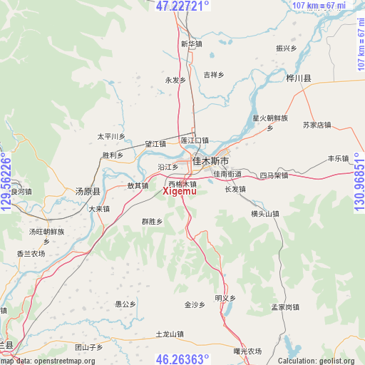
Xigemu GPS coordinates[2]
46° 44' 51.252" North, 130° 15' 55.368" East
| Map corner | latitude | longitude |
|---|---|---|
| Upper-left | 47.22721°, | 129.56226° |
| Center: | 46.74757°, | 130.26538° |
| Lower-right: | 46.26363°, | 130.96851° |
| Map W x H: | 107.1×107.1 km | = 66.5×66.5mi |
| max Lat: | 53.31946° ⇑3.6% North |
| Xigemu: | 46.74757° |
| min Lat: | ⇓96.4% South 18.22056° |
| min Long | Xigemu | max Long |
| 75.07348° | 130.26538° | 134.28917° |
| W 99.3%⇐ | ⇒0.7% E |
Elevation
Elevation of Xigemu is 111 m = 364 ft, and this is 373.8 m = 1226 ft below average elevation for this country.
| Max E: |
5622 m = 18445 ft | 58.1% |
| Avg. | 484.8 m = 1591 ft | |
| Xigemu | 111 m = 364 ft | |
Min E: |
-3 m = -10 ft | 41.9% |
See also: China elevation on elevation.city.
Geographical zone
Xigemu is located in North temperate zone (between Tropic of Cancer and the Arctic Circle). Distance of this North polar circle is 2203.3 km =1369.1 mi to North.| Distance of | km | miles | from Xigemu |
|---|---|---|---|
| North Pole | 4809.2 | 2988.3 | to North |
| Arctic Circle | 2203.3 | 1369.1 | to North |
| Tropic Cancer | 2591.9 | 1610.5 | to South |
| Equator | 5197.8 | 3229.8 | to South |


Nearby cities:
15 places around Xigemu: (largest is in red/bold)
• Aoqi
13.1 km =8.1 mi,  267°
267°
• Changfa
15.5 km =9.6 mi,  96°
96°
• Changqing
6.3 km =3.9 mi,  17°
17°
• Jiamusi
6.9 km =4.3 mi,  34°
34°
• Jianguo
12.6 km =7.8 mi,  51°
51°
• Lianjiangkou
13.1 km =8.1 mi,  14°
14°
• Ping’an
15 km =9.3 mi, 15°
• Qiaonan
9.4 km =5.8 mi, 48°
• Qunsheng
14 km =8.7 mi,  218°
218°
• Shengli
21.9 km =13.6 mi,  292°
292°
• Songjiang
15.9 km =9.9 mi, 52°
• Wangjiang
14.3 km =8.9 mi,  326°
326°
• Yanjiang
6.5 km =4 mi,  319°
319°
• Youyi
7.6 km =4.7 mi, 32°
• Zhanqian
10.2 km =6.3 mi,  55°
55°
Sources, notices
• [Note1] Compared only with cities in China existing in our database
• [Src1] Map data: © OpenStreetMap contributors (CC-BY-SA)
• [Src2] Other city data from geonames.org with taken over terms of usage.
• [Src3] Geographical zone / Annual Mean Temperature by Robert A. Rohde @ Wikipedia
