Xiangshun geodata
Xiangshun (Heilongjiang) is a seat of a fourth-order administrative division; located in China in Asia/Shanghai (GMT+8) time zone. In our database, there are 1268 cities with bigger population. Compared to other cities in China, 95.1% of cities are located further ↓South; 98.5% of cities are located further ←West and 57.9% of cities have higher elevation than Xiangshun. Note1


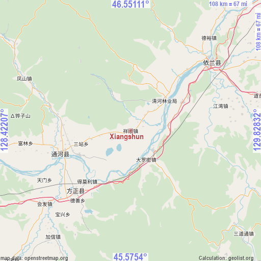
Xiangshun GPS coordinates[2]
46° 3' 55.476" North, 129° 7' 30.684" East
| Map corner | latitude | longitude |
|---|---|---|
| Upper-left | 46.55111°, | 128.42207° |
| Center: | 46.06541°, | 129.12519° |
| Lower-right: | 45.5754°, | 129.82832° |
| Map W x H: | 108.5×108.5 km | = 67.4×67.4mi |
| max Lat: | 53.31946° ⇑4.9% North |
| Xiangshun: | 46.06541° |
| min Lat: | ⇓95.1% South 18.22056° |
| min Long | Xiangshun | max Long |
| 75.07348° | 129.12519° | 134.28917° |
| W 98.5%⇐ | ⇒1.5% E |
Elevation
Elevation of Xiangshun is 112 m = 367 ft, and this is 372.8 m = 1223 ft below average elevation for this country.
| Max E: |
5622 m = 18445 ft | 57.9% |
| Avg. | 484.8 m = 1591 ft | |
| Xiangshun | 112 m = 367 ft | |
Min E: |
-3 m = -10 ft | 42.1% |
See also: China elevation on elevation.city.
Geographical zone
Xiangshun is located in North temperate zone (between Tropic of Cancer and the Arctic Circle). Distance of this North polar circle is 2279.2 km =1416.2 mi to North.| Distance of | km | miles | from Xiangshun |
|---|---|---|---|
| North Pole | 4885.1 | 3035.5 | to North |
| Arctic Circle | 2279.2 | 1416.2 | to North |
| Tropic Cancer | 2516.1 | 1563.4 | to South |
| Equator | 5122 | 3182.7 | to South |


Nearby cities:
15 places around Xiangshun: (largest is in red/bold)
• Baoxing
44.7 km =27.8 mi,  218°
218°
• Dalianhe
24.4 km =15.2 mi,  61°
61°
• Daluomi
13.5 km =8.4 mi,  152°
152°
• Fangzheng
34.1 km =21.2 mi, 222°
• Fengshan
49.3 km =30.6 mi,  296°
296°
• Huifa
46.9 km =29.1 mi,  229°
229°
• Jiangwan
38.7 km =24 mi,  74°
74°
• Qinghe
19.3 km =12 mi,  47°
47°
• Songnan
32.7 km =20.3 mi, 230°
• Tianmen
41 km =25.5 mi,  240°
240°
• Tonghe
31.1 km =19.3 mi,  251°
251°
• Wuyapao
23.7 km =14.7 mi, 245°
• Yihantong
27.5 km =17.1 mi, 220°
• Yilan
43.2 km =26.8 mi, 49°
• Yinglan
44.5 km =27.7 mi, 46°
Sources, notices
• [Note1] Compared only with cities in China existing in our database
• [Src1] Map data: © OpenStreetMap contributors (CC-BY-SA)
• [Src2] Other city data from geonames.org with taken over terms of usage.
• [Src3] Geographical zone / Annual Mean Temperature by Robert A. Rohde @ Wikipedia
