Bianjiang geodata
Bianjiang (Heilongjiang) is a seat of a third-order administrative division; located in China in Asia/Shanghai (GMT+8) time zone. In our database, there are 1268 cities with bigger population. Compared to other cities in China, 99.5% of cities are located further ↓South; 98.2% of cities are located further ←West and 54.9% of cities have higher elevation than Bianjiang. Note1


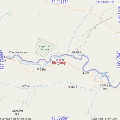
Bianjiang GPS coordinates[2]
49° 33' 28.08" North, 128° 28' 23.052" East
| Map corner | latitude | longitude |
|---|---|---|
| Upper-left | 50.01178°, | 127.76995° |
| Center: | 49.5578°, | 128.47307° |
| Lower-right: | 49.09956°, | 129.1762° |
| Map W x H: | 101.4×101.4 km | = 63×63mi |
| max Lat: | 53.31946° ⇑0.5% North |
| Bianjiang: | 49.5578° |
| min Lat: | ⇓99.5% South 18.22056° |
| min Long | Bianjiang | max Long |
| 75.07348° | 128.47307° | 134.28917° |
| W 98.2%⇐ | ⇒1.8% E |
Elevation
Elevation of Bianjiang is 132 m = 433 ft, and this is 352.8 m = 1157 ft below average elevation for this country.
| Max E: |
5622 m = 18445 ft | 54.9% |
| Avg. | 484.8 m = 1591 ft | |
| Bianjiang | 132 m = 433 ft | |
Min E: |
-3 m = -10 ft | 45.1% |
See also: China elevation on elevation.city.
Geographical zone
Bianjiang is located in North temperate zone (between Tropic of Cancer and the Arctic Circle). Distance of this North polar circle is 1890.9 km =1175 mi to North.| Distance of | km | miles | from Bianjiang |
|---|---|---|---|
| North Pole | 4496.8 | 2794.2 | to North |
| Arctic Circle | 1890.9 | 1175 | to North |
| Tropic Cancer | 2904.4 | 1804.7 | to South |
| Equator | 5510.3 | 3423.9 | to South |


Nearby cities:
15 places around Bianjiang: (largest is in red/bold)
• Aihui
85.3 km =53 mi,  303°
303°
• Baoshan
61.7 km =38.3 mi,  147°
147°
• Changsheng
77 km =47.8 mi,  102°
102°
• Chelu
26 km =16.2 mi,  119°
119°
• Fendou
85.7 km =53.3 mi,  234°
234°
• Ganchazi
17.7 km =11 mi,  237°
237°
• Kunheda Woerzu Manzu
78.6 km =48.8 mi, 297°
• Qunshan
75.3 km =46.8 mi, 239°
• Songshugou
26.6 km =16.5 mi, 154°
• Sunwu
85.1 km =52.9 mi,  259°
259°
• Xinxing
43.6 km =27.1 mi, 118°
• Xin’e
58 km =36 mi,  218°
218°
• Xunhe
37.5 km =23.3 mi, 230°
• Yanjiang
49.8 km =30.9 mi,  271°
271°
• Yaotun
71.9 km =44.7 mi, 259°
Sources, notices
• [Note1] Compared only with cities in China existing in our database
• [Src1] Map data: © OpenStreetMap contributors (CC-BY-SA)
• [Src2] Other city data from geonames.org with taken over terms of usage.
• [Src3] Geographical zone / Annual Mean Temperature by Robert A. Rohde @ Wikipedia
