Changsheng geodata
Changsheng (Heilongjiang) is a seat of a fourth-order administrative division; located in China in Asia/Shanghai (GMT+8) time zone. In our database, there are 1268 cities with bigger population. Compared to other cities in China, 99.4% of cities are located further ↓South; 98.8% of cities are located further ←West and 60.6% of cities have higher elevation than Changsheng. Note1


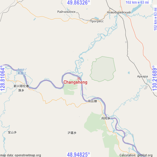
Changsheng GPS coordinates[2]
49° 24' 28.404" North, 129° 30' 49.536" East
| Map corner | latitude | longitude |
|---|---|---|
| Upper-left | 49.86326°, | 128.81064° |
| Center: | 49.40789°, | 129.51376° |
| Lower-right: | 48.94825°, | 130.21689° |
| Map W x H: | 101.7×101.7 km | = 63.2×63.2mi |
| max Lat: | 53.31946° ⇑0.6% North |
| Changsheng: | 49.40789° |
| min Lat: | ⇓99.4% South 18.22056° |
| min Long | Changsheng | max Long |
| 75.07348° | 129.51376° | 134.28917° |
| W 98.8%⇐ | ⇒1.2% E |
Elevation
Elevation of Changsheng is 95 m = 312 ft, and this is 389.8 m = 1279 ft below average elevation for this country.
| Max E: |
5622 m = 18445 ft | 60.6% |
| Avg. | 484.8 m = 1591 ft | |
| Changsheng | 95 m = 312 ft | |
Min E: |
-3 m = -10 ft | 39.4% |
See also: China elevation on elevation.city.
Geographical zone
Changsheng is located in North temperate zone (between Tropic of Cancer and the Arctic Circle). Distance of this North polar circle is 1907.5 km =1185.3 mi to North.| Distance of | km | miles | from Changsheng |
|---|---|---|---|
| North Pole | 4513.4 | 2804.5 | to North |
| Arctic Circle | 1907.5 | 1185.3 | to North |
| Tropic Cancer | 2887.7 | 1794.3 | to South |
| Equator | 5493.6 | 3413.6 | to South |


Nearby cities:
15 places around Changsheng: (largest is in red/bold)
• Baoshan
55.1 km =34.2 mi,  230°
230°
• Baoxing
114.3 km =71 mi,  140°
140°
• Bianjiang
77 km =47.8 mi,  282°
282°
• Chaoyang
86.9 km =54 mi,  131°
131°
• Chelu
52.8 km =32.8 mi,  274°
274°
• Ganchazi
90.5 km =56.2 mi, 274°
• Hongguang
98.6 km =61.3 mi, 132°
• Hujia
35.2 km =21.9 mi,  187°
187°
• Kelin
87.5 km =54.4 mi,  208°
208°
• Qingshan
89.6 km =55.7 mi,  161°
161°
• Songshugou
64.4 km =40 mi,  263°
263°
• Wuyun
17 km =10.6 mi,  148°
148°
• Xiangyang
30.8 km =19.1 mi, 145°
• Xinxing
37.3 km =23.2 mi, 263°
• Xunhe
104.6 km =65 mi, 266°
Sources, notices
• [Note1] Compared only with cities in China existing in our database
• [Src1] Map data: © OpenStreetMap contributors (CC-BY-SA)
• [Src2] Other city data from geonames.org with taken over terms of usage.
• [Src3] Geographical zone / Annual Mean Temperature by Robert A. Rohde @ Wikipedia
