Kalaxilike geodata
Kalaxilike (Xinjiang) is a seat of a fourth-order administrative division; located in China in Asia/Urumqi (GMT+6) time zone. In our database, there are 1268 cities with bigger population. Compared to other cities in China, 98.2% of cities are located further ↓South; 98.1% of cities are located further →East and 73.8% of cities have lower elevation than Kalaxilike. Note1


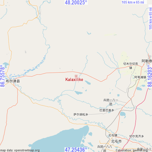
Kalaxilike GPS coordinates[2]
47° 43' 46.02" North, 87° 27' 32.04" East
| Map corner | latitude | longitude |
|---|---|---|
| Upper-left | 48.20025°, | 86.75578° |
| Center: | 47.72945°, | 87.4589° |
| Lower-right: | 47.25436°, | 88.16203° |
| Map W x H: | 105.2×105.2 km | = 65.4×65.4mi |
| max Lat: | 53.31946° ⇑1.8% North |
| Kalaxilike: | 47.72945° |
| min Lat: | ⇓98.2% South 18.22056° |
| min Long | Kalaxilike | max Long |
| 75.07348° | 87.4589° | 134.28917° |
| W 1.9%⇐ | ⇒98.1% E |
Elevation
Elevation of Kalaxilike is 496 m = 1627 ft, and this is 11.2 m = 37 ft above average elevation for this country.
| Max E: |
5622 m = 18445 ft | 26.2% |
| Kalaxilike | 496 m 1627 ft | |
| Avg. | 484.8 m = 1591 ft | |
Min E: |
-3 m = -10 ft | 73.8% |
See also: China elevation on elevation.city.
Geographical zone
Kalaxilike is located in North temperate zone (between Tropic of Cancer and the Arctic Circle). Distance of this North polar circle is 2094.2 km =1301.3 mi to North.| Distance of | km | miles | from Kalaxilike |
|---|---|---|---|
| North Pole | 4700 | 2920.4 | to North |
| Arctic Circle | 2094.2 | 1301.3 | to North |
| Tropic Cancer | 2701.1 | 1678.4 | to South |
| Equator | 5307 | 3297.6 | to South |


Nearby cities:
15 places around Kalaxilike: (largest is in red/bold)
• Alakak
3.4 km =2.1 mi,  60°
60°
• Altay
52.1 km =32.4 mi,  75°
75°
• Awiytan
44.3 km =27.5 mi,  90°
90°
• A’erda
66.4 km =41.3 mi,  176°
176°
• Balbagay
31.7 km =19.7 mi,  137°
137°
• Beitun
49.9 km =31 mi,  147°
147°
• Egiztobe
36.9 km =22.9 mi,  293°
293°
• Handegate
69 km =42.9 mi, 86°
• Hongdun
56.8 km =35.3 mi, 90°
• Kostik
11.5 km =7.1 mi,  303°
303°
• Lasite
51.8 km =32.2 mi,  69°
69°
• Oymak
38.8 km =24.1 mi, 295°
• Sa’erhusong
26.9 km =16.7 mi,  166°
166°
• Xemirxek
38.6 km =24 mi, 78°
• Xirikxiy
59 km =36.7 mi,  134°
134°
Sources, notices
• [Note1] Compared only with cities in China existing in our database
• [Src1] Map data: © OpenStreetMap contributors (CC-BY-SA)
• [Src2] Other city data from geonames.org with taken over terms of usage.
• [Src3] Geographical zone / Annual Mean Temperature by Robert A. Rohde @ Wikipedia
