Altay geodata
Altay (Xinjiang) is a seat of a third-order administrative division; located in China in Asia/Urumqi (GMT+6) time zone. With population of 139,341 people, there are 316 cities with bigger population in this country. Compared to other cities in China, 98.4% of cities are located further ↓South; 97.8% of cities are located further →East and 83.3% of cities have lower elevation than Altay. Note1


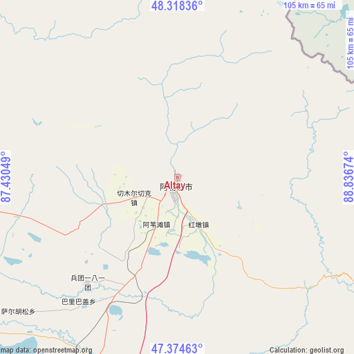
Altay GPS coordinates[2]
47° 50' 55.104" North, 88° 8' 0.996" East
| Map corner | latitude | longitude |
|---|---|---|
| Upper-left | 48.31836°, | 87.43049° |
| Center: | 47.84864°, | 88.13361° |
| Lower-right: | 47.37463°, | 88.83674° |
| Map W x H: | 104.9×104.9 km | = 65.2×65.2mi |
| max Lat: | 53.31946° ⇑1.6% North |
| Altay: | 47.84864° |
| min Lat: | ⇓98.4% South 18.22056° |
| min Long | Altay | max Long |
| 75.07348° | 88.13361° | 134.28917° |
| W 2.2%⇐ | ⇒97.8% E |
Elevation
Elevation of Altay is 866 m = 2841 ft, and this is 381.2 m = 1251 ft above average elevation for this country.
| Max E: |
5622 m = 18445 ft | 16.7% |
| Altay | 866 m 2841 ft | |
| Avg. | 484.8 m = 1591 ft | |
Min E: |
-3 m = -10 ft | 83.3% |
See also: Altay elevation on elevation.city.
Geographical zone
Altay is located in North temperate zone (between Tropic of Cancer and the Arctic Circle). Distance of this North polar circle is 2080.9 km =1293 mi to North.| Distance of | km | miles | from Altay |
|---|---|---|---|
| North Pole | 4686.8 | 2912.2 | to North |
| Arctic Circle | 2080.9 | 1293 | to North |
| Tropic Cancer | 2714.4 | 1686.6 | to South |
| Equator | 5320.3 | 3305.9 | to South |


Nearby cities:
15 places around Altay: (largest is in red/bold)
• Alakak
48.9 km =30.4 mi,  256°
256°
• Awiytan
15.1 km =9.4 mi,  204°
204°
• A’erda
92.4 km =57.4 mi,  210°
210°
• Balbagay
47 km =29.2 mi,  218°
218°
• Beitun
60 km =37.3 mi, 203°
• Egiztobe
84.2 km =52.3 mi,  270°
270°
• Handegate
20.4 km =12.7 mi,  115°
115°
• Hongdun
15.2 km =9.4 mi,  155°
155°
• Kalaxilike
52.1 km =32.4 mi, 255°
• Kostik
60.3 km =37.5 mi, 263°
• Lasite
5 km =3.1 mi,  338°
338°
• Oymak
85.4 km =53.1 mi, 272°
• Sa’erhusong
59.3 km =36.8 mi,  228°
228°
• Xemirxek
13.8 km =8.6 mi,  244°
244°
• Xirikxiy
55.5 km =34.5 mi,  188°
188°
Sources, notices
• [Note1] Compared only with cities in China existing in our database
• [Src1] Map data: © OpenStreetMap contributors (CC-BY-SA)
• [Src2] Other city data from geonames.org with taken over terms of usage.
• [Src3] Geographical zone / Annual Mean Temperature by Robert A. Rohde @ Wikipedia
