Bayin geodata
Bayin (Inner Mongolia) is a seat of a fourth-order administrative division; located in China in Asia/Shanghai (GMT+8) time zone. In our database, there are 1268 cities with bigger population. Compared to other cities in China, 90.4% of cities are located further ↓South; 59.4% of cities are located further →East and 90.6% of cities have lower elevation than Bayin. Note1


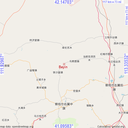
Bayin GPS coordinates[2]
41° 37' 24.852" North, 112° 37' 55.884" East
| Map corner | latitude | longitude |
|---|---|---|
| Upper-left | 42.14703°, | 111.92907° |
| Center: | 41.62357°, | 112.63219° |
| Lower-right: | 41.09583°, | 113.33532° |
| Map W x H: | 116.9×116.9 km | = 72.6×72.6mi |
| max Lat: | 53.31946° ⇑9.6% North |
| Bayin: | 41.62357° |
| min Lat: | ⇓90.4% South 18.22056° |
| min Long | Bayin | max Long |
| 75.07348° | 112.63219° | 134.28917° |
| W 40.6%⇐ | ⇒59.4% E |
Elevation
Elevation of Bayin is 1417 m = 4649 ft, and this is 932.2 m = 3058 ft above average elevation for this country.
| Max E: |
5622 m = 18445 ft | 9.4% |
| Bayin | 1417 m 4649 ft | |
| Avg. | 484.8 m = 1591 ft | |
Min E: |
-3 m = -10 ft | 90.6% |
See also: China elevation on elevation.city.
Geographical zone
Bayin is located in North temperate zone (between Tropic of Cancer and the Arctic Circle). Distance of this Northern Tropic circle is 2022.2 km =1256.5 mi to South.| Distance of | km | miles | from Bayin |
|---|---|---|---|
| North Pole | 5379 | 3342.4 | to North |
| Arctic Circle | 2773.1 | 1723.1 | to North |
| Tropic Cancer | 2022.2 | 1256.5 | to South |
| Equator | 4628.1 | 2875.8 | to South |


Nearby cities:
15 places around Bayin: (largest is in red/bold)
• Bulianhe
19 km =11.8 mi,  212°
212°
• Chahannao
19.3 km =12 mi,  94°
94°
• Danglang Hudong
23.9 km =14.9 mi,  76°
76°
• Guangyilong
29.9 km =18.6 mi,  257°
257°
• Hongpan
27.1 km =16.8 mi,  153°
153°
• Huangyangcheng
29.7 km =18.5 mi,  224°
224°
• Huashanzi
29.9 km =18.6 mi,  270°
270°
• Kulun
15.2 km =9.4 mi,  10°
10°
• Sandaogou
27.2 km =16.9 mi,  176°
176°
• Sanjinquan
26.7 km =16.6 mi,  38°
38°
• Teshage
8.8 km =5.5 mi, 217°
• Tuchengzi
25 km =15.5 mi,  236°
236°
• Wuhao
29.7 km =18.5 mi,  250°
250°
• Wusutu
9.6 km =6 mi,  71°
71°
• Yifaquan
8.8 km =5.5 mi, 269°
Sources, notices
• [Note1] Compared only with cities in China existing in our database
• [Src1] Map data: © OpenStreetMap contributors (CC-BY-SA)
• [Src2] Other city data from geonames.org with taken over terms of usage.
• [Src3] Geographical zone / Annual Mean Temperature by Robert A. Rohde @ Wikipedia
