Chahannao geodata
Chahannao (Inner Mongolia) is a seat of a fourth-order administrative division; located in China in Asia/Shanghai (GMT+8) time zone. In our database, there are 1268 cities with bigger population. Compared to other cities in China, 90.3% of cities are located further ↓South; 58.3% of cities are located further →East and 90.7% of cities have lower elevation than Chahannao. Note1


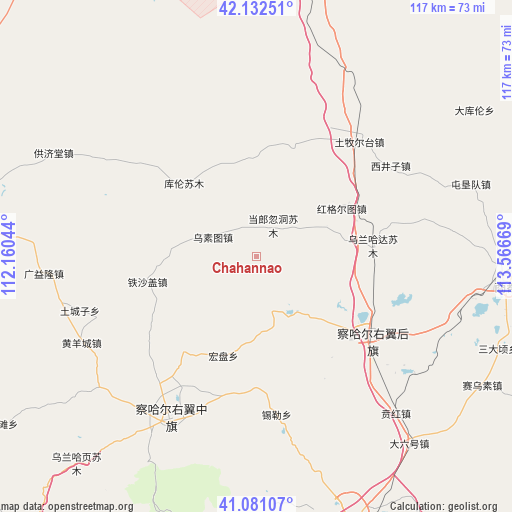
Chahannao GPS coordinates[2]
41° 36' 32.148" North, 112° 51' 48.816" East
| Map corner | latitude | longitude |
|---|---|---|
| Upper-left | 42.13251°, | 112.16044° |
| Center: | 41.60893°, | 112.86356° |
| Lower-right: | 41.08107°, | 113.56669° |
| Map W x H: | 116.9×116.9 km | = 72.6×72.6mi |
| max Lat: | 53.31946° ⇑9.7% North |
| Chahannao: | 41.60893° |
| min Lat: | ⇓90.3% South 18.22056° |
| min Long | Chahannao | max Long |
| 75.07348° | 112.86356° | 134.28917° |
| W 41.7%⇐ | ⇒58.3% E |
Elevation
Elevation of Chahannao is 1423 m = 4669 ft, and this is 938.2 m = 3078 ft above average elevation for this country.
| Max E: |
5622 m = 18445 ft | 9.3% |
| Chahannao | 1423 m 4669 ft | |
| Avg. | 484.8 m = 1591 ft | |
Min E: |
-3 m = -10 ft | 90.7% |
See also: China elevation on elevation.city.
Geographical zone
Chahannao is located in North temperate zone (between Tropic of Cancer and the Arctic Circle). Distance of this Northern Tropic circle is 2020.6 km =1255.5 mi to South.| Distance of | km | miles | from Chahannao |
|---|---|---|---|
| North Pole | 5380.6 | 3343.3 | to North |
| Arctic Circle | 2774.7 | 1724.1 | to North |
| Tropic Cancer | 2020.6 | 1255.5 | to South |
| Equator | 4626.5 | 2874.8 | to South |


Nearby cities:
15 places around Chahannao: (largest is in red/bold)
• Aguitu
29.4 km =18.3 mi,  51°
51°
• Baiyin Chagan
31.7 km =19.7 mi,  123°
123°
• Bayin
19.3 km =12 mi,  274°
274°
• Bulianhe
32.9 km =20.4 mi,  244°
244°
• Danglang Hudong
8.3 km =5.2 mi,  28°
28°
• Hongge’ertu
25.8 km =16 mi,  68°
68°
• Hongpan
23.9 km =14.9 mi,  197°
197°
• Jigun Tala
22.1 km =13.7 mi,  18°
18°
• Kulun
23.3 km =14.5 mi,  315°
315°
• Sandaogou
31.1 km =19.3 mi,  214°
214°
• Sanjinquan
22.6 km =14 mi,  353°
353°
• Teshage
25.2 km =15.7 mi,  257°
257°
• Wulan Hada
26.9 km =16.7 mi,  84°
84°
• Wusutu
11.2 km =7 mi,  295°
295°
• Yifaquan
28 km =17.4 mi, 273°
Sources, notices
• [Note1] Compared only with cities in China existing in our database
• [Src1] Map data: © OpenStreetMap contributors (CC-BY-SA)
• [Src2] Other city data from geonames.org with taken over terms of usage.
• [Src3] Geographical zone / Annual Mean Temperature by Robert A. Rohde @ Wikipedia
