Liuying geodata
Liuying (Henan) is a seat of a fourth-order administrative division; located in China in Asia/Shanghai (GMT+8) time zone. In our database, there are 1268 cities with bigger population. Compared to other cities in China, 81% of cities are located further ↓South; 51.1% of cities are located further ←West and 62.9% of cities have higher elevation than Liuying. Note1


Liuying GPS coordinates[2]
38° 3' 10.98" North, 114° 25' 20.172" East
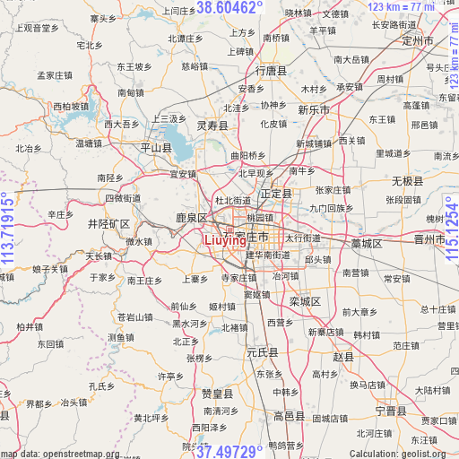
| Map corner | latitude | longitude |
|---|---|---|
| Upper-left | 38.60462°, | 113.71915° |
| Center: | 38.05305°, | 114.42227° |
| Lower-right: | 37.49729°, | 115.1254° |
| Map W x H: | 123.1×123.1 km | = 76.5×76.5mi |
| max Lat: | 53.31946° ⇑19% North |
| Liuying: | 38.05305° |
| min Lat: | ⇓81% South 18.22056° |
| min Long | Liuying | max Long |
| 75.07348° | 114.42227° | 134.28917° |
| W 51.1%⇐ | ⇒48.9% E |
Elevation
Elevation of Liuying is 83 m = 272 ft, and this is 401.8 m = 1318 ft below average elevation for this country.
| Max E: |
5622 m = 18445 ft | 62.9% |
| Avg. | 484.8 m = 1591 ft | |
| Liuying | 83 m = 272 ft | |
Min E: |
-3 m = -10 ft | 37.1% |
See also: China elevation on elevation.city.
Geographical zone
Liuying is located in North temperate zone (between Tropic of Cancer and the Arctic Circle). Distance of this Northern Tropic circle is 1625.2 km =1009.9 mi to South.| Distance of | km | miles | from Liuying |
|---|---|---|---|
| North Pole | 5776 | 3589 | to North |
| Arctic Circle | 3170.1 | 1969.8 | to North |
| Tropic Cancer | 1625.2 | 1009.9 | to South |
| Equator | 4231.1 | 2629.1 | to South |


Nearby cities:
15 places around Liuying: (largest is in red/bold)
• Bailuquan
13.5 km =8.4 mi,  278°
278°
• Daguo
2.5 km =1.6 mi,  335°
335°
• Dahe
10.2 km =6.3 mi, 337°
• Dubei
8.9 km =5.5 mi,  5°
5°
• Ershilipu
13.5 km =8.4 mi,  99°
99°
• Huolu
11.5 km =7.1 mi,  285°
285°
• Licun
17.4 km =10.8 mi, 335°
• Nancun
18.8 km =11.7 mi,  86°
86°
• Shangzhuang
5.1 km =3.2 mi,  241°
241°
• Shijiazhuang
5.1 km =3.2 mi, 104°
• Shijing
13 km =8.1 mi,  296°
296°
• Songying
18.1 km =11.2 mi, 99°
• Taoyuan
8.9 km =5.5 mi,  68°
68°
• Xizhaotong
15.4 km =9.6 mi,  82°
82°
• Zhaolingpu
6.3 km =3.9 mi,  36°
36°
Sources, notices
• [Note1] Compared only with cities in China existing in our database
• [Src1] Map data: © OpenStreetMap contributors (CC-BY-SA)
• [Src2] Other city data from geonames.org with taken over terms of usage.
• [Src3] Geographical zone / Annual Mean Temperature by Robert A. Rohde @ Wikipedia
