Huanghuatala geodata
Huanghuatala (Inner Mongolia) is a seat of a fourth-order administrative division; located in China in Asia/Shanghai (GMT+8) time zone. In our database, there are 1268 cities with bigger population. Compared to other cities in China, 91.5% of cities are located further ↓South; 86.7% of cities are located further ←West and 69.8% of cities have lower elevation than Huanghuatala. Note1


Huanghuatala GPS coordinates[2]
42° 39' 25.776" North, 120° 46' 36.732" East
| Map corner | latitude | longitude |
|---|---|---|
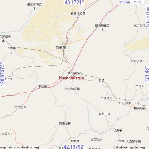
| Upper-left | 43.1721°, | 120.07375° |
| Center: | 42.65716°, | 120.77687° |
| Lower-right: | 42.13792°, | 121.48° |
| Map W x H: | 115×115 km | = 71.5×71.5mi |
| max Lat: | 53.31946° ⇑8.5% North |
| Huanghuatala: | 42.65716° |
| min Lat: | ⇓91.5% South 18.22056° |
| min Long | Huanghuatala | max Long |
| 75.07348° | 120.77687° | 134.28917° |
| W 86.7%⇐ | ⇒13.3% E |
Elevation
Elevation of Huanghuatala is 408 m = 1339 ft, and this is 76.8 m = 252 ft below average elevation for this country.
| Max E: |
5622 m = 18445 ft | 30.2% |
| Avg. | 484.8 m = 1591 ft | |
| Huanghuatala | 408 m = 1339 ft | |
Min E: |
-3 m = -10 ft | 69.8% |
See also: China elevation on elevation.city.
Geographical zone
Huanghuatala is located in North temperate zone (between Tropic of Cancer and the Arctic Circle). Distance of this Northern Tropic circle is 2137.1 km =1327.9 mi to South.| Distance of | km | miles | from Huanghuatala |
|---|---|---|---|
| North Pole | 5264 | 3270.9 | to North |
| Arctic Circle | 2658.1 | 1651.7 | to North |
| Tropic Cancer | 2137.1 | 1327.9 | to South |
| Equator | 4743 | 2947.2 | to South |


Nearby cities:
15 places around Huanghuatala: (largest is in red/bold)
• Baga Borihe
34.7 km =21.6 mi,  329°
329°
• Beipiao
96.2 km =59.8 mi,  179°
179°
• Beisijia
57.4 km =35.7 mi,  188°
188°
• Daqin Tal
26.9 km =16.7 mi,  341°
341°
• Fuxin
101.7 km =63.2 mi,  134°
134°
• Heichengzi
59.8 km =37.2 mi,  164°
164°
• Kailu
108.6 km =67.5 mi,  18°
18°
• Kulun
82 km =51 mi,  84°
84°
• Loujiadian
67.2 km =41.8 mi, 187°
• Taijiying
56.5 km =35.1 mi, 163°
• Tuchengzi
35.4 km =22 mi, 175°
• Xar Holoi
11 km =6.8 mi, 189°
• Xiawa
21 km =13 mi,  247°
247°
• Xinhui
83.2 km =51.7 mi,  240°
240°
• Yilongyong
10.8 km =6.7 mi,  259°
259°
Sources, notices
• [Note1] Compared only with cities in China existing in our database
• [Src1] Map data: © OpenStreetMap contributors (CC-BY-SA)
• [Src2] Other city data from geonames.org with taken over terms of usage.
• [Src3] Geographical zone / Annual Mean Temperature by Robert A. Rohde @ Wikipedia
