Baga Borihe geodata
Baga Borihe (Inner Mongolia) is a seat of a fourth-order administrative division; located in China in Asia/Shanghai (GMT+8) time zone. In our database, there are 1268 cities with bigger population. Compared to other cities in China, 91.9% of cities are located further ↓South; 85.5% of cities are located further ←West and 67.2% of cities have lower elevation than Baga Borihe. Note1


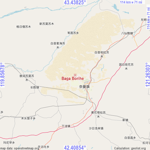
Baga Borihe GPS coordinates[2]
42° 55' 31.98" North, 120° 33' 35.64" East
| Map corner | latitude | longitude |
|---|---|---|
| Upper-left | 43.43825°, | 119.85678° |
| Center: | 42.92555°, | 120.5599° |
| Lower-right: | 42.40854°, | 121.26303° |
| Map W x H: | 114.5×114.5 km | = 71.1×71.1mi |
| max Lat: | 53.31946° ⇑8.1% North |
| Baga Borihe: | 42.92555° |
| min Lat: | ⇓91.9% South 18.22056° |
| min Long | Baga Borihe | max Long |
| 75.07348° | 120.5599° | 134.28917° |
| W 85.5%⇐ | ⇒14.5% E |
Elevation
Elevation of Baga Borihe is 362 m = 1188 ft, and this is 122.8 m = 403 ft below average elevation for this country.
| Max E: |
5622 m = 18445 ft | 32.8% |
| Avg. | 484.8 m = 1591 ft | |
| Baga Borihe | 362 m = 1188 ft | |
Min E: |
-3 m = -10 ft | 67.2% |
See also: China elevation on elevation.city.
Geographical zone
Baga Borihe is located in North temperate zone (between Tropic of Cancer and the Arctic Circle). Distance of this Northern Tropic circle is 2167 km =1346.5 mi to South.| Distance of | km | miles | from Baga Borihe |
|---|---|---|---|
| North Pole | 5234.2 | 3252.4 | to North |
| Arctic Circle | 2628.3 | 1633.1 | to North |
| Tropic Cancer | 2167 | 1346.5 | to South |
| Equator | 4772.9 | 2965.7 | to South |


Nearby cities:
15 places around Baga Borihe: (largest is in red/bold)
• Beisijia
87.2 km =54.2 mi,  173°
173°
• Daqin Tal
10.3 km =6.4 mi,  114°
114°
• Heichengzi
93.8 km =58.3 mi,  158°
158°
• Huanghuatala
34.7 km =21.6 mi,  149°
149°
• Kailu
89.6 km =55.7 mi,  35°
35°
• Kulun
101.5 km =63.1 mi,  102°
102°
• Loujiadian
96.9 km =60.2 mi, 174°
• Taijiying
90.6 km =56.3 mi, 158°
• Tianshan
113.4 km =70.5 mi,  340°
340°
• Tuchengzi
68.3 km =42.4 mi, 162°
• Wudan
125.1 km =77.7 mi,  270°
270°
• Xar Holoi
43.6 km =27.1 mi, 158°
• Xiawa
37.8 km =23.5 mi,  182°
182°
• Xinhui
89.6 km =55.7 mi,  217°
217°
• Yilongyong
32.6 km =20.3 mi, 167°
Sources, notices
• [Note1] Compared only with cities in China existing in our database
• [Src1] Map data: © OpenStreetMap contributors (CC-BY-SA)
• [Src2] Other city data from geonames.org with taken over terms of usage.
• [Src3] Geographical zone / Annual Mean Temperature by Robert A. Rohde @ Wikipedia
