Yilongyong geodata
Yilongyong (Inner Mongolia) is a seat of a fourth-order administrative division; located in China in Asia/Shanghai (GMT+8) time zone. In our database, there are 1268 cities with bigger population. Compared to other cities in China, 91.5% of cities are located further ↓South; 85.9% of cities are located further ←West and 69.6% of cities have lower elevation than Yilongyong. Note1


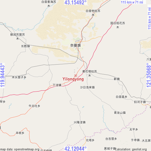
Yilongyong GPS coordinates[2]
42° 38' 23.388" North, 120° 38' 51.18" East
| Map corner | latitude | longitude |
|---|---|---|
| Upper-left | 43.15492°, | 119.94443° |
| Center: | 42.63983°, | 120.64755° |
| Lower-right: | 42.12044°, | 121.35068° |
| Map W x H: | 115×115 km | = 71.5×71.5mi |
| max Lat: | 53.31946° ⇑8.5% North |
| Yilongyong: | 42.63983° |
| min Lat: | ⇓91.5% South 18.22056° |
| min Long | Yilongyong | max Long |
| 75.07348° | 120.64755° | 134.28917° |
| W 85.9%⇐ | ⇒14.1% E |
Elevation
Elevation of Yilongyong is 403 m = 1322 ft, and this is 81.8 m = 268 ft below average elevation for this country.
| Max E: |
5622 m = 18445 ft | 30.4% |
| Avg. | 484.8 m = 1591 ft | |
| Yilongyong | 403 m = 1322 ft | |
Min E: |
-3 m = -10 ft | 69.6% |
See also: China elevation on elevation.city.
Geographical zone
Yilongyong is located in North temperate zone (between Tropic of Cancer and the Arctic Circle). Distance of this Northern Tropic circle is 2135.2 km =1326.8 mi to South.| Distance of | km | miles | from Yilongyong |
|---|---|---|---|
| North Pole | 5266 | 3272.1 | to North |
| Arctic Circle | 2660.1 | 1652.9 | to North |
| Tropic Cancer | 2135.2 | 1326.8 | to South |
| Equator | 4741.1 | 2946 | to South |


Nearby cities:
15 places around Yilongyong: (largest is in red/bold)
• Baga Borihe
32.6 km =20.3 mi,  347°
347°
• Beipiao
94.9 km =59 mi,  173°
173°
• Beisijia
55 km =34.2 mi,  177°
177°
• Daqin Tal
27.6 km =17.1 mi,  4°
4°
• Fuxin
108.3 km =67.3 mi,  129°
129°
• Heichengzi
61.8 km =38.4 mi,  154°
154°
• Huanghuatala
10.8 km =6.7 mi,  79°
79°
• Kailu
114.1 km =70.9 mi,  23°
23°
• Kulun
92.7 km =57.6 mi, 83°
• Loujiadian
64.7 km =40.2 mi, 178°
• Taijiying
58.7 km =36.5 mi, 152°
• Tuchengzi
35.9 km =22.3 mi,  158°
158°
• Xar Holoi
12.5 km =7.8 mi,  135°
135°
• Xiawa
10.7 km =6.6 mi,  236°
236°
• Xinhui
73.1 km =45.4 mi, 237°
Sources, notices
• [Note1] Compared only with cities in China existing in our database
• [Src1] Map data: © OpenStreetMap contributors (CC-BY-SA)
• [Src2] Other city data from geonames.org with taken over terms of usage.
• [Src3] Geographical zone / Annual Mean Temperature by Robert A. Rohde @ Wikipedia
