Sanhe geodata
Sanhe (Qinghai) is a seat of a fourth-order administrative division; located in China in Asia/Shanghai (GMT+8) time zone. In our database, there are 1268 cities with bigger population. Compared to other cities in China, 78.1% of cities are located further ↓South; 93% of cities are located further →East and 96% of cities have lower elevation than Sanhe. Note1


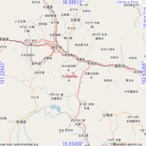
Sanhe GPS coordinates[2]
36° 25' 20.712" North, 101° 55' 46.38" East
| Map corner | latitude | longitude |
|---|---|---|
| Upper-left | 36.98613°, | 101.22643° |
| Center: | 36.42242°, | 101.92955° |
| Lower-right: | 35.85459°, | 102.63268° |
| Map W x H: | 125.8×125.8 km | = 78.2×78.2mi |
| max Lat: | 53.31946° ⇑21.9% North |
| Sanhe: | 36.42242° |
| min Lat: | ⇓78.1% South 18.22056° |
| min Long | Sanhe | max Long |
| 75.07348° | 101.92955° | 134.28917° |
| W 7%⇐ | ⇒93% E |
Elevation
Elevation of Sanhe is 2558 m = 8392 ft, and this is 2073.2 m = 6802 ft above average elevation for this country.
| Max E: |
5622 m = 18445 ft | 4% |
| Sanhe | 2558 m 8392 ft | |
| Avg. | 484.8 m = 1591 ft | |
Min E: |
-3 m = -10 ft | 96% |
See also: China elevation on elevation.city.
Geographical zone
Sanhe is located in North temperate zone (between Tropic of Cancer and the Arctic Circle). Distance of this Northern Tropic circle is 1443.9 km =897.2 mi to South.| Distance of | km | miles | from Sanhe |
|---|---|---|---|
| North Pole | 5957.3 | 3701.7 | to North |
| Arctic Circle | 3351.4 | 2082.5 | to North |
| Tropic Cancer | 1443.9 | 897.2 | to South |
| Equator | 4049.8 | 2516.4 | to South |


Nearby cities:
15 places around Sanhe: (largest is in red/bold)
• Ershilipu
35.5 km =22.1 mi,  333°
333°
• Ganhetan
39.1 km =24.3 mi,  283°
283°
• Gaozhai
14.4 km =8.9 mi,  20°
20°
• Gucheng
9.3 km =5.8 mi,  140°
140°
• Hongshuiquan
6.3 km =3.9 mi,  317°
317°
• Kanbula
35.1 km =21.8 mi,  191°
191°
• Lushar
33.5 km =20.8 mi, 281°
• Shangxinzhuang
32.2 km =20 mi,  267°
267°
• Shihuiyao
6.2 km =3.9 mi,  225°
225°
• Sitai
6.1 km =3.8 mi,  179°
179°
• Tianjiazhai
12.7 km =7.9 mi,  285°
285°
• Xiaoxia
12.5 km =7.8 mi, 15°
• Xining
27.3 km =17 mi, 325°
• Yashiga
39 km =24.2 mi, 179°
• Zongzhai
23.1 km =14.4 mi,  300°
300°
Sources, notices
• [Note1] Compared only with cities in China existing in our database
• [Src1] Map data: © OpenStreetMap contributors (CC-BY-SA)
• [Src2] Other city data from geonames.org with taken over terms of usage.
• [Src3] Geographical zone / Annual Mean Temperature by Robert A. Rohde @ Wikipedia
