Luobuqiongzi geodata
Luobuqiongzi (Tibet) is a seat of a third-order administrative division; located in China in Asia/Shanghai (GMT+8) time zone. In our database, there are 1268 cities with bigger population. Compared to other cities in China, 63.6% of cities are located further ↑North; 97.5% of cities are located further →East and 98.6% of cities have lower elevation than Luobuqiongzi. Note1


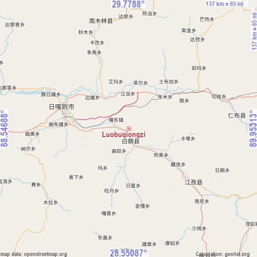
Luobuqiongzi GPS coordinates[2]
29° 10' 0.012" North, 89° 15' 0" East
| Map corner | latitude | longitude |
|---|---|---|
| Upper-left | 29.7788°, | 88.54688° |
| Center: | 29.16667°, | 89.25° |
| Lower-right: | 28.55087°, | 89.95313° |
| Map W x H: | 136.5×136.5 km | = 84.8×84.8mi |
| max Lat: | 53.31946° ⇑63.6% North |
| Luobuqiongzi: | 29.16667° |
| min Lat: | ⇓36.4% South 18.22056° |
| min Long | Luobuqiongzi | max Long |
| 75.07348° | 89.25° | 134.28917° |
| W 2.5%⇐ | ⇒97.5% E |
Elevation
Elevation of Luobuqiongzi is 3970 m = 13025 ft, and this is 3485.2 m = 11434 ft above average elevation for this country.
| Max E: |
5622 m = 18445 ft | 1.4% |
| Luobuqiongzi | 3970 m 13025 ft | |
| Avg. | 484.8 m = 1591 ft | |
Min E: |
-3 m = -10 ft | 98.6% |
See also: China elevation on elevation.city.
Geographical zone
Luobuqiongzi is located in North temperate zone (between Tropic of Cancer and the Arctic Circle). Distance of this Northern Tropic circle is 637.1 km =395.9 mi to South.| Distance of | km | miles | from Luobuqiongzi |
|---|---|---|---|
| North Pole | 6764 | 4203 | to North |
| Arctic Circle | 4158.1 | 2583.7 | to North |
| Tropic Cancer | 637.1 | 395.9 | to South |
| Equator | 3243 | 2015.1 | to South |


Nearby cities:
15 places around Luobuqiongzi: (largest is in red/bold)
• Bazha
10.9 km =6.8 mi,  280°
280°
• Bianxiong
25.7 km =16 mi,  311°
311°
• Car
25.5 km =15.8 mi,  14°
14°
• Dazi
21.1 km =13.1 mi,  120°
120°
• Duqiong
14.7 km =9.1 mi,  180°
180°
• Gadong
8.6 km =5.3 mi, 306°
• Jangdam
19.1 km =11.9 mi,  358°
358°
• Karmai
24.1 km =15 mi,  98°
98°
• Luojiang
6.9 km =4.3 mi,  168°
168°
• Ma Xiang
24.6 km =15.3 mi,  214°
214°
• Nianmu
25.7 km =16 mi,  47°
47°
• Qiangdui
14.2 km =8.8 mi,  127°
127°
• Rasog
21.8 km =13.5 mi, 127°
• Rixing
29.5 km =18.3 mi, 175°
• Zhongzi
26 km =16.2 mi, 128°
Sources, notices
• [Note1] Compared only with cities in China existing in our database
• [Src1] Map data: © OpenStreetMap contributors (CC-BY-SA)
• [Src2] Other city data from geonames.org with taken over terms of usage.
• [Src3] Geographical zone / Annual Mean Temperature by Robert A. Rohde @ Wikipedia
