Xinyuan geodata
Xinyuan (Xinjiang) is a populated place; located in China in Asia/Urumqi (GMT+6) time zone. With population of 300,000 people, there are 179 cities with bigger population in this country. Compared to other cities in China, 92.3% of cities are located further ↓South; 98.9% of cities are located further →East and 84.6% of cities have lower elevation than Xinyuan. Note1


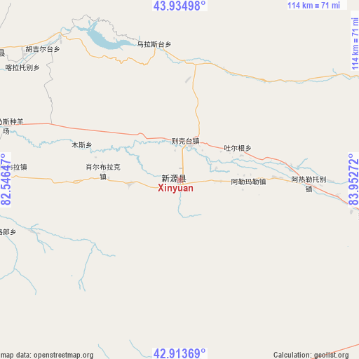
Xinyuan GPS coordinates[2]
43° 25' 35.364" North, 83° 14' 58.524" East
| Map corner | latitude | longitude |
|---|---|---|
| Upper-left | 43.93498°, | 82.54647° |
| Center: | 43.42649°, | 83.24959° |
| Lower-right: | 42.91369°, | 83.95272° |
| Map W x H: | 113.6×113.6 km | = 70.6×70.6mi |
| max Lat: | 53.31946° ⇑7.7% North |
| Xinyuan: | 43.42649° |
| min Lat: | ⇓92.3% South 18.22056° |
| min Long | Xinyuan | max Long |
| 75.07348° | 83.24959° | 134.28917° |
| W 1.1%⇐ | ⇒98.9% E |
Elevation
Elevation of Xinyuan is 953 m = 3127 ft, and this is 468.2 m = 1536 ft above average elevation for this country.
| Max E: |
5622 m = 18445 ft | 15.4% |
| Xinyuan | 953 m 3127 ft | |
| Avg. | 484.8 m = 1591 ft | |
Min E: |
-3 m = -10 ft | 84.6% |
See also: Xinyuan elevation on elevation.city.
Geographical zone
Xinyuan is located in North temperate zone (between Tropic of Cancer and the Arctic Circle). Distance of this Northern Tropic circle is 2222.7 km =1381.1 mi to South.| Distance of | km | miles | from Xinyuan |
|---|---|---|---|
| North Pole | 5178.5 | 3217.8 | to North |
| Arctic Circle | 2572.6 | 1598.5 | to North |
| Tropic Cancer | 2222.7 | 1381.1 | to South |
| Equator | 4828.6 | 3000.4 | to South |


Nearby cities:
15 places around Xinyuan: (largest is in red/bold)
• Agarsin
68.3 km =42.4 mi,  275°
275°
• Araltobe
41.6 km =25.8 mi,  92°
92°
• Hujirti
112 km =69.6 mi,  258°
258°
• Karasu
97.3 km =60.5 mi,  298°
298°
• Karatobe
61.1 km =38 mi,  305°
305°
• Kax
113.7 km =70.6 mi, 282°
• Muhur
55.9 km =34.7 mi,  243°
243°
• Nilka
72.8 km =45.2 mi, 303°
• Suptay
107 km =66.5 mi, 302°
• Taldi
15.9 km =9.9 mi, 264°
• Tikerik
96.3 km =59.8 mi, 275°
• Tokkuztara
89 km =55.3 mi,  272°
272°
• Türgen
19.4 km =12.1 mi,  61°
61°
• Xorbulak
23.6 km =14.7 mi, 276°
• Zekti
12.5 km =7.8 mi,  10°
10°
Sources, notices
• [Note1] Compared only with cities in China existing in our database
• [Src1] Map data: © OpenStreetMap contributors (CC-BY-SA)
• [Src2] Other city data from geonames.org with taken over terms of usage.
• [Src3] Geographical zone / Annual Mean Temperature by Robert A. Rohde @ Wikipedia
